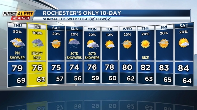
Yellow Alert Weather for Friday: Tracking heavy rain and flash flooding

ROCHESTER, N.Y. — So far on Thursday, the weather has held up nicely. Conditions remain comfortable and breezy along with a mixture of sun and clouds.
There have been a few showers but nothing heavy so far. A few isolated showers will remain in the forecast throughout the remainder of Thursday but the heaviest of the rain will arrive Friday.
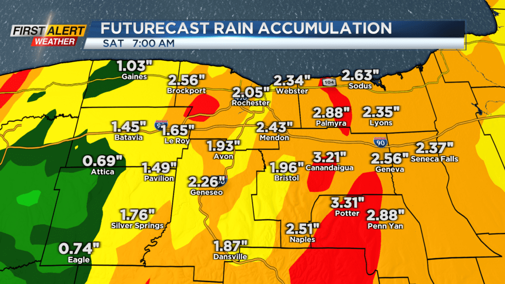
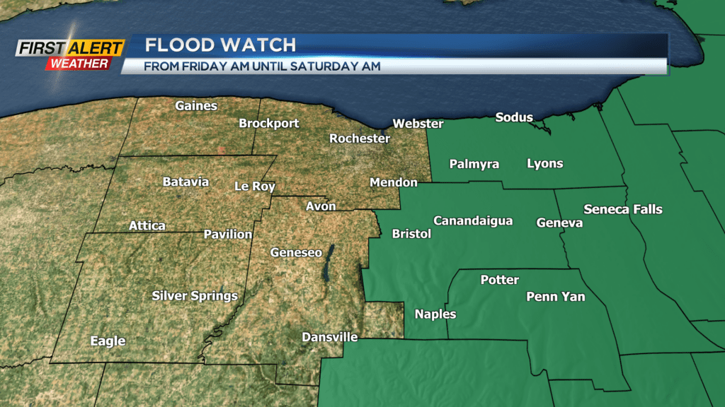
A Yellow Alert remains in effect for Friday as we will likely see tropical downpours fall across our region with the likelihood that flooding or flash flooding occurs for some areas. The National Weather Service has issued a Flood Watch for Wayne, Ontario, Seneca, and Yates Counties for Friday as these areas will have the greatest threat for flooding.
Rain will likely begin to develop from south to north on Friday around daybreak. That rain will quickly envelope our region with heavy rain by the middle of the morning. Rain and heavy rain continues through lunchtime and into the middle of the afternoon before we transition over to scattered showers Friday evening.
Scattered showers will continue before things dry out early Friday night. This is not a long lived event but with the tropical moisture in place rain showers will have a chance to dump a good amount of rain in a short period of time that could lead to flooding.
Rainfall rates Friday morning and afternoon will have a chance to exceed 1.5 inches per hour which would increase our threat for flash flooding. Not everyone will see these intense downpours but those that do will have a greater chance for flooding.
A few showers will continue into Friday night but by Saturday morning we will see partly cloudy skies and sunshine to start the day. Things will also turn much more comfortable Saturday as dew points drop along with breezy conditions.