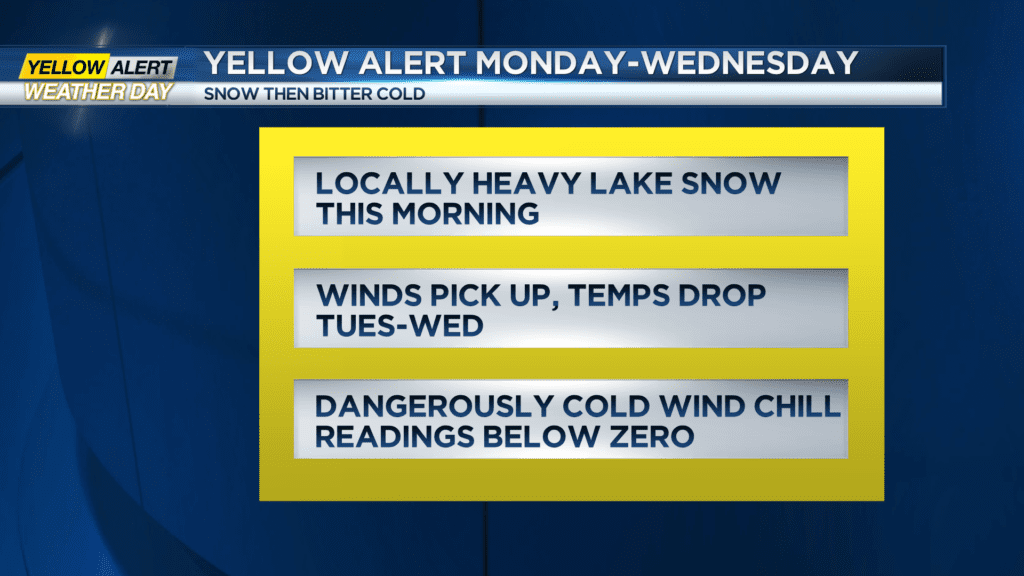
Yellow Alert Weather: Snow has stopped but bitter cold remains on Monday afternoon
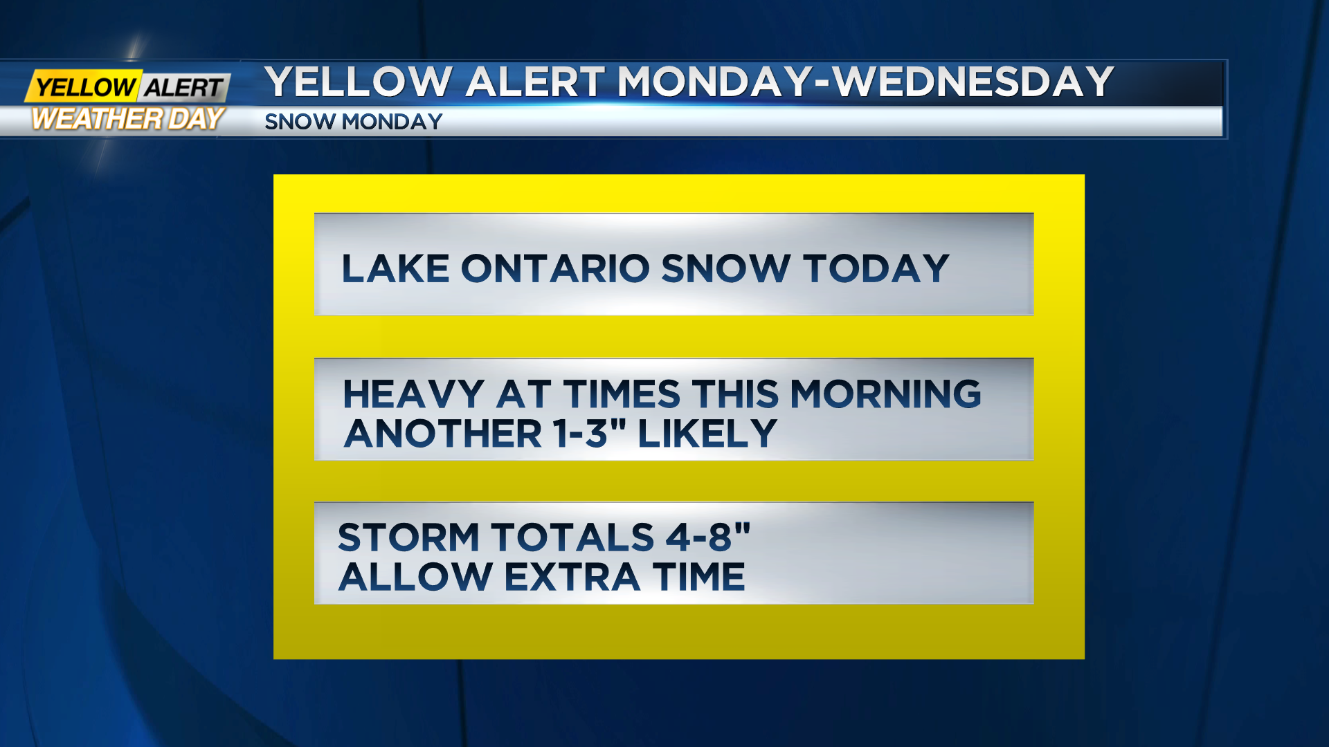
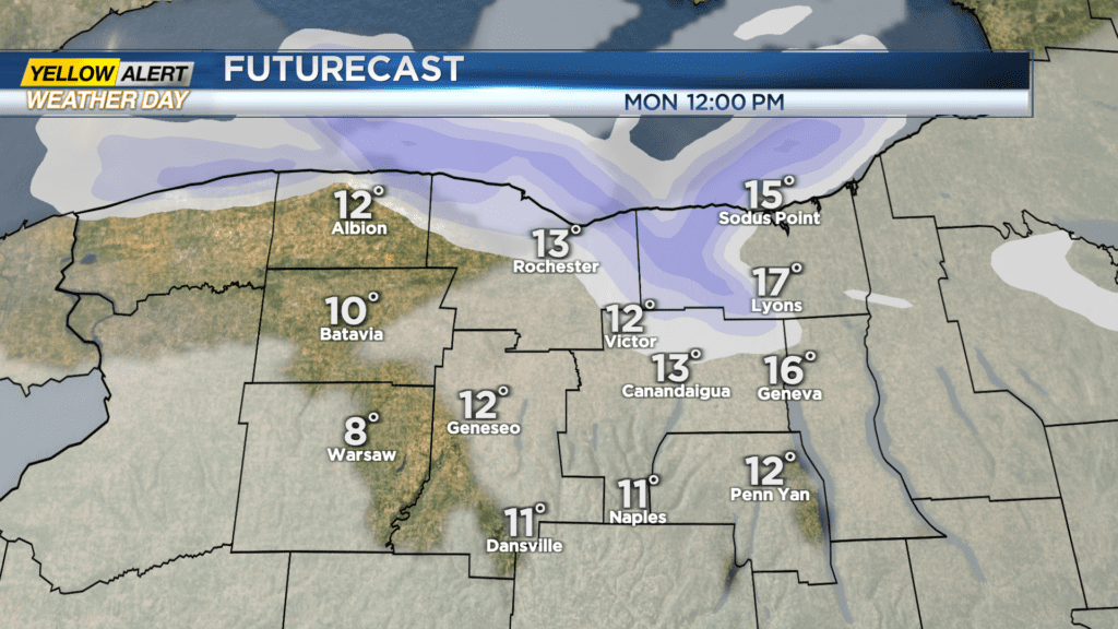
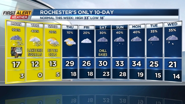
ROCHESTER, N.Y. — The heaviest lake effect snow on Monday morning has cleared in the Rochester region. Snow totals in the four to eight-inch range were common north of the Thruway.
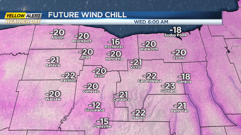
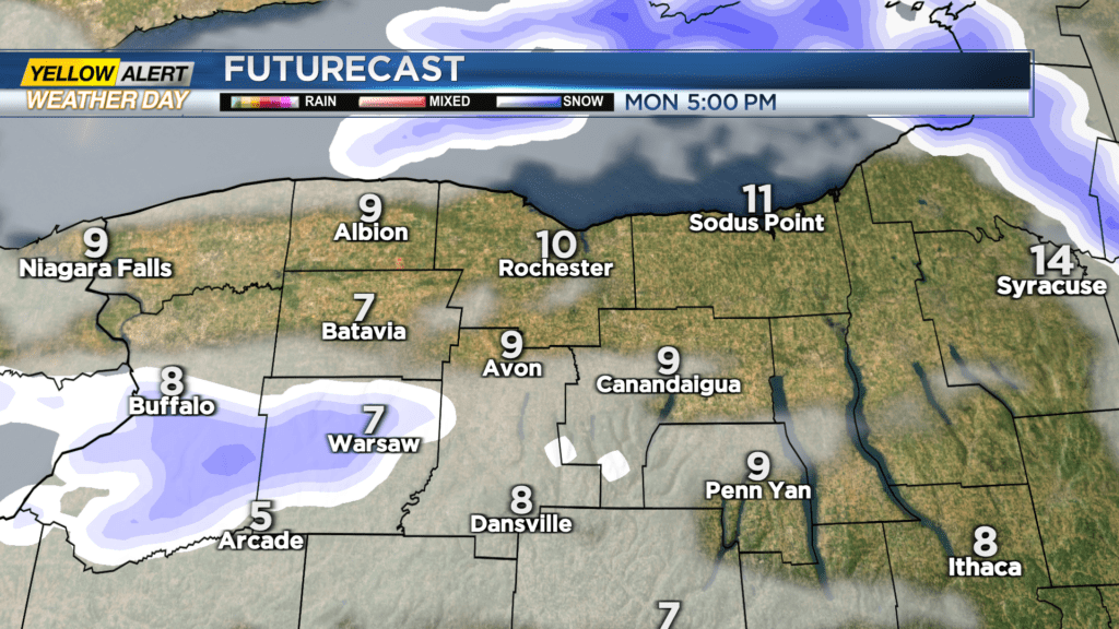
Increasing winds will cause some blowing snow and will push the wind chill reading well below zero into Tuesday and Wednesday. The Yellow Alert will continue due to the dangerous cold. Additional snow will be light in Rochester but for areas to the south and west, the Lake Erie snowband will get better organized on Monday night into Tuesday.
Several inches of snow will fall for parts of Genesee and Wyoming counties with lighter amounts to the east into the Finger Lakes. Be prepared for difficult travel at times due to local lake snow and areas of blowing snow through midweek. Wind chill readings will reach -10 to -20 degrees at times on Tuesday into Wednesday.
Stay tuned to News10NBC for the latest updates on the snow and cold for our Yellow Alert.