First Alert Weather: Yellow Alert posted for the potential of strong storms on Monday
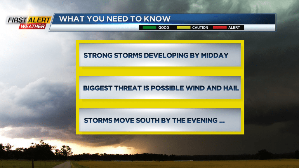
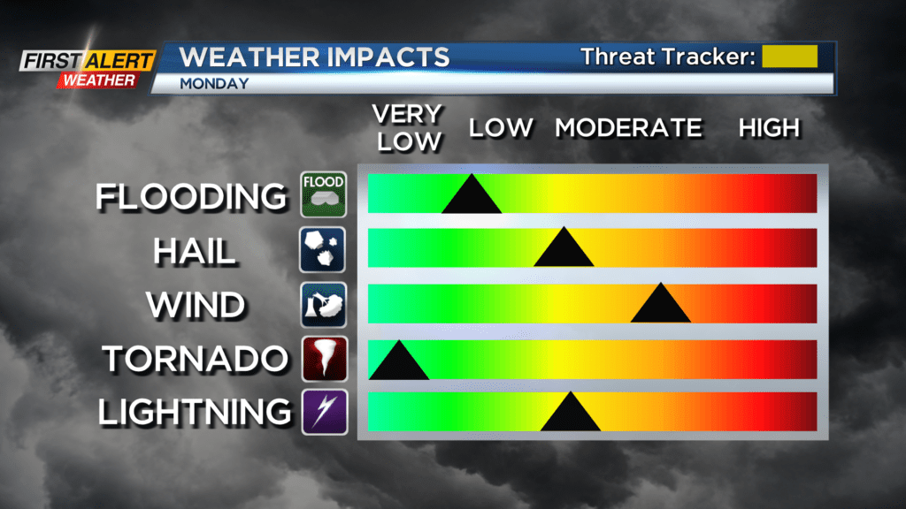
ROCHESTER, N.Y. – Some pleasant weather ends the first weekend of August with calm conditions expected into this Sunday evening. Then a cold front will sweep across Western New York on Monday. This cooler, drier airmass will plow into the heat and humidity which will fire up some showers and thunderstorms. Some of these storms could be strong to severe with the greatest threat being straight-line winds and hail. The highest probability for these storms will be located south and east of Rochester going into the afternoon. As a result of this potential, the News10NBC First Alert weather team has issued a Yellow Alert on the threat tracker for Monday.
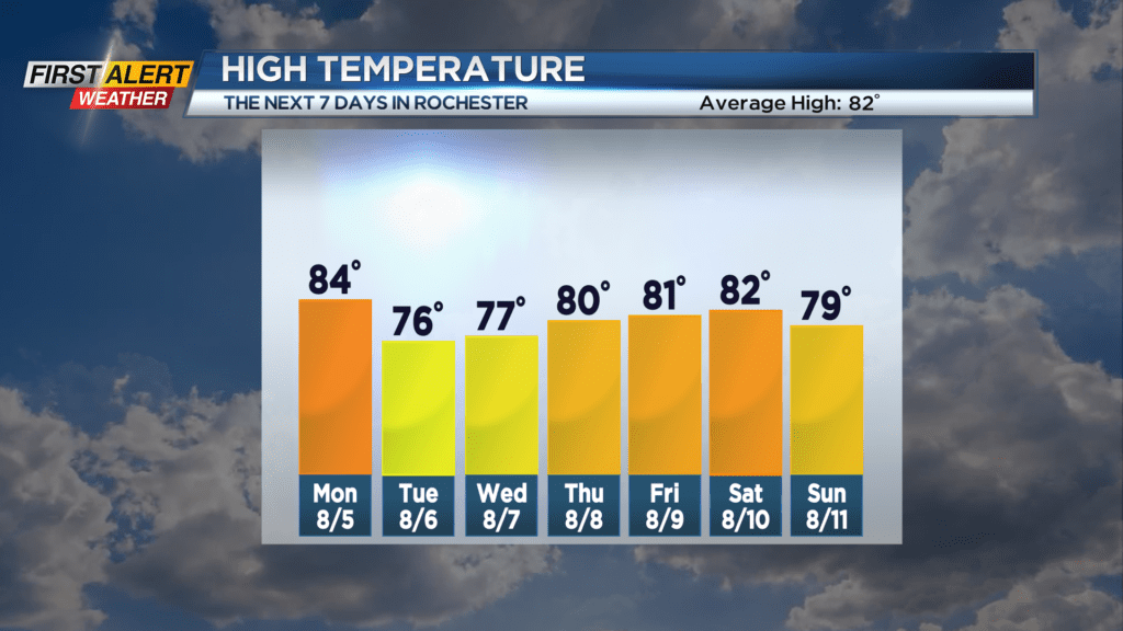
Sunday night look for clear to partly cloudy skies. Expect plenty of humidity with the low temperature near 67 degrees. Monday is a News 10NBC Yellow Alert day. You can expect partial sunshine with lots of humidity. However, showers and strong thunderstorms will develop by late morning into the afternoon. Watch for a torrential downpour, lightning with possible hail, and gusty winds. The high temperature will be in the middle 80s. Showers will move south and taper by Monday evening. The low temperature will be in the middle 60s. There is a small chance of a shower on Tuesday morning, but it will be a much cooler and drier day. The mercury will rise into the mid-70s.
Stay tuned to News 10NBC First Alert Weather for updates on the forecast.

