First Alert Weather: Tracking lake effect snow on Wednesday night through Friday

ROCHESTER, N.Y. — It’s a foggy Wednesday morning in Rochester, with visibility fluctuating from less than a mile to the southwest to a couple of miles in Rochester.
There is widespread rain ongoing east of Rochester. Later in the morning, rain will be falling over Rochester and the surrounding counties. That rain will continue through the afternoon, at which time there will be a transition to a wintry mix and wet snow in parts of Genesee, Wyoming, Livingston, and Ontario counties.
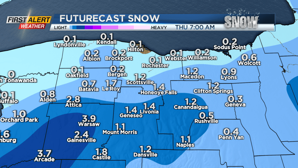
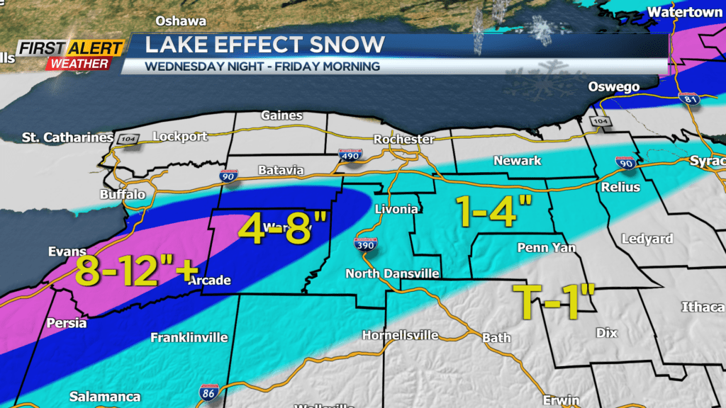
That rain and snow will pull away afterward but then a snow band off Lake Erie will develop and last overnight all the way to Friday morning. Just before sunrise, that snow band could briefly sneak into Monroe County but it is not currently forecasted to last long there, meaning by Thursday morning there will only be minor accumulation in Rochester.
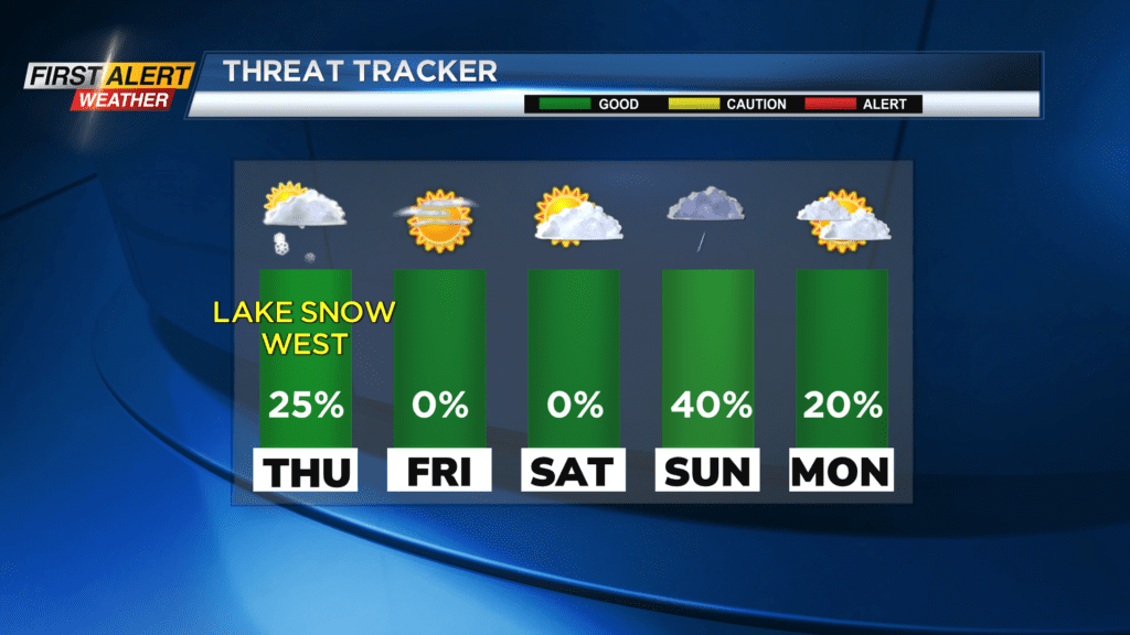
Areas south of the Thruway could see 1-2 inches of snow by Thursday morning and parts of Wyoming County could see up to 4 inches by then. Our threat tracker is currently green but we encourage you to stay tuned in case any developments in the forecast indicate more significant impacts to the area.
That Lake Erie snow band should move south of Wyoming County by Friday morning. By that point, the snowfall totals will have reached up to 1 inch in Rochester, 1 to 4 inches south of the Thruway in Livingston and Ontario counties, and 4 to 8 inches and perhaps a little more south of the Thruway in parts of Genesee and Wyoming counties.
Stay tuned to News10 NBC to see how this forecast develops.


