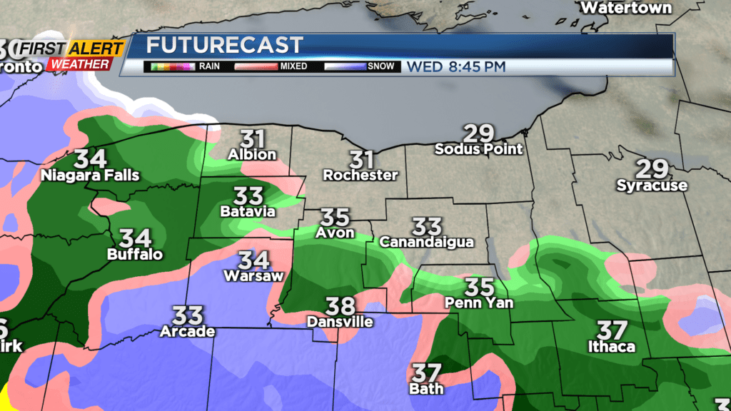
First Alert Weather: Another round of rain/snow late Wednesday
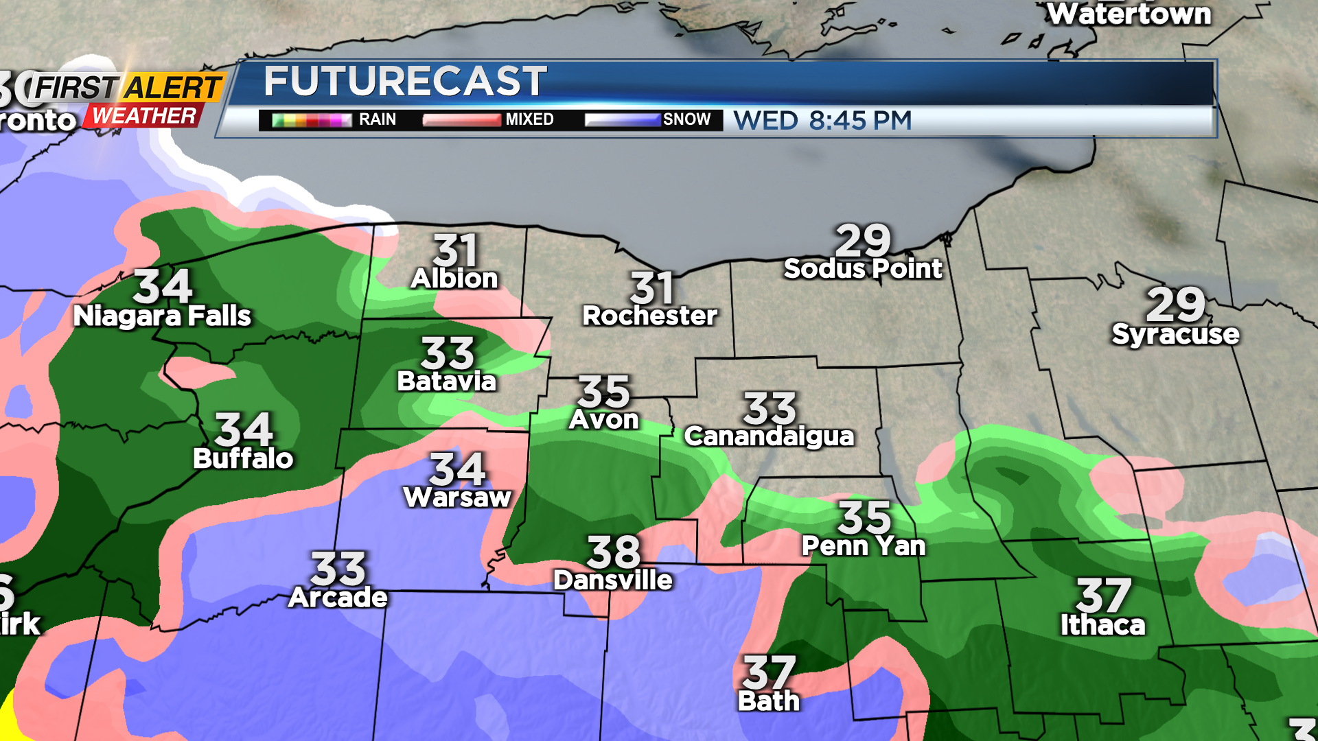
ROCHESTER, N.Y. – Enjoy the little bit of quiet and dry weather we’ll have Tuesday night and into much of Wednesday, as our next area of low pressure arrives late Wednesday. We may even see some breaks of sun at times on Wednesday, with temperatures once again in the lower 40s. This will help to melt some of the snow and ice that we’ve been chipping away at the last few days. Our next system will bring a mix of rain and wet snow Wednesday night into early Thursday, followed by falling temperatures and some scattered snow showers Thursday afternoon and evening. Any accumulation should be minor, but we may pick up a coating to an inch of snow later Thursday and into early Friday.
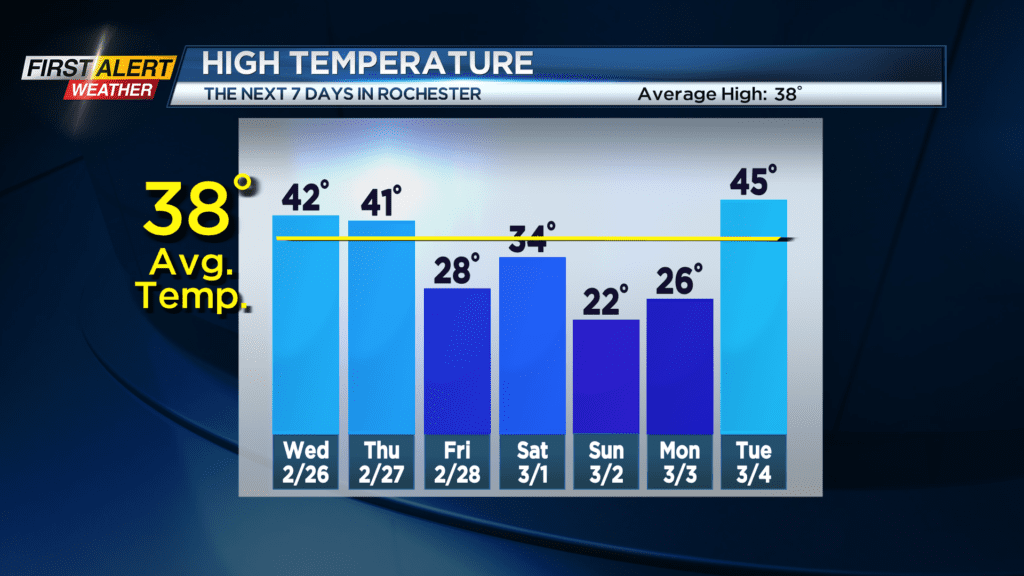
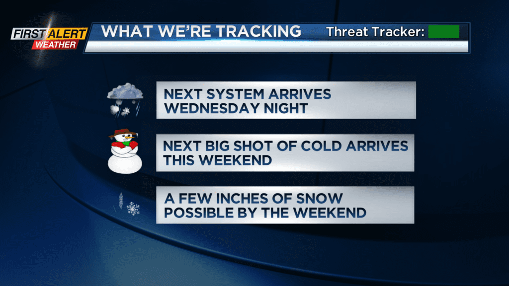
Our next system will follow quickly Friday night, with another round of snow, possibly changing briefly over to rain early Saturday, then back over to snow showers as temperatures drop and winds pick up.
The second half of the weekend will remain cold, with highs on Sunday remaining in the lower 20s, along with some limited lake effect snow. Monday also stays on the chilly side, before our next stronger system approaches, nudging our temperatures back into the 40s and possibly 50s for the middle of next week, followed by another shot of wintry air.