First Alert Weather: A cold but sunny Sunday, then an active weather pattern ahead
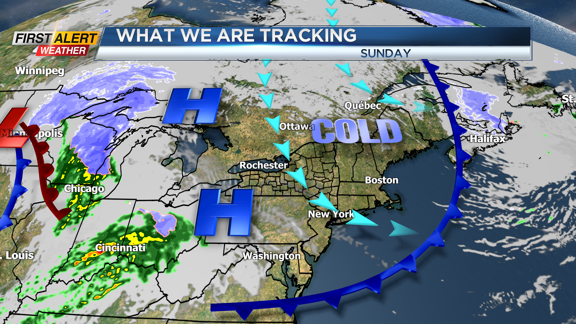
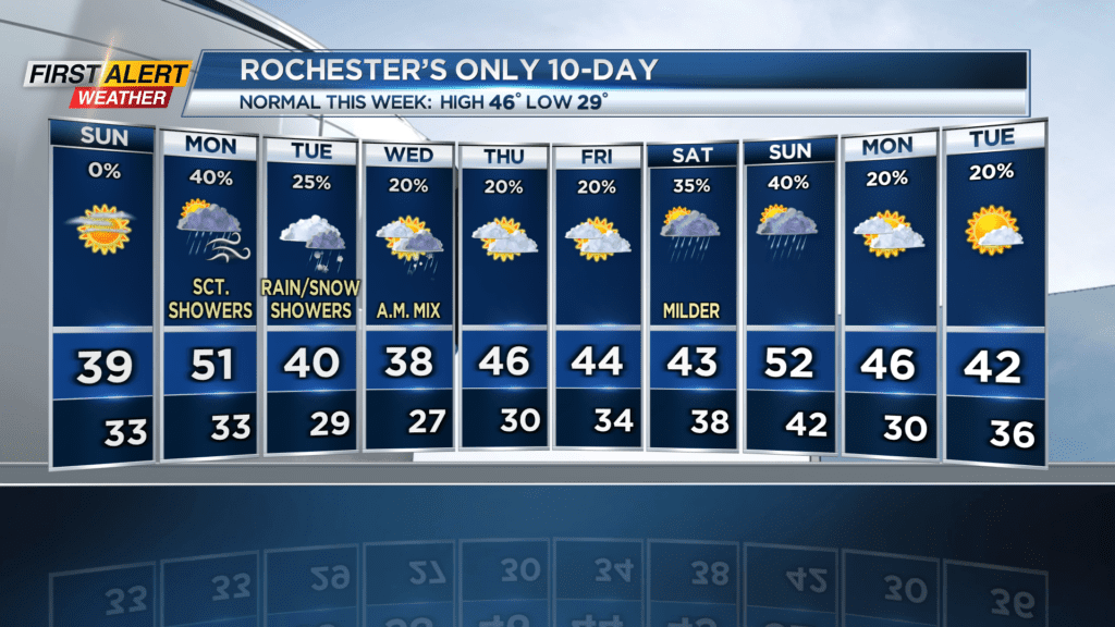
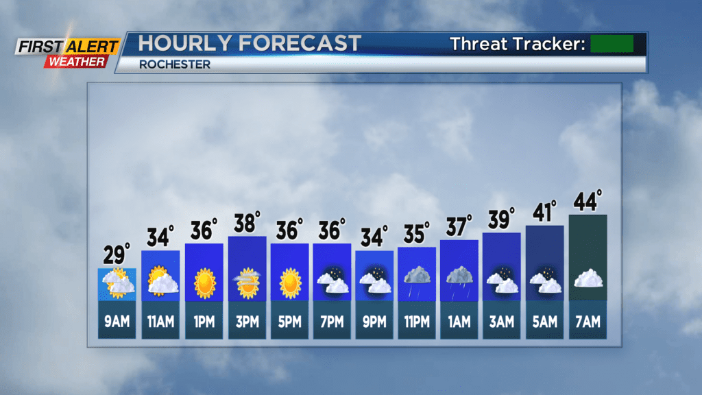
ROCHESTER, N.Y. – If you get the chance, make sure you get outside today, as there will be plenty of sunshine to go around, and very calm winds means no wind chill… Even if it is still pretty cold out. We’re starting off in the low 20s, but we’ll rise to the high 30s and maybe even the low 40s if our temperatures keep overperforming as they have been lately. Areas along the lakeshore will be cooler – only up to the low to mid 30s. High level (A.K.A. cirrus) clouds will move in this afternoon which will be a very pretty sight, then clouds thicken going into the evening and overnight, temperatures will rise as a warm front moves in and gives us a mix of rain and snow. Temperatures at the surface will stay above freezing and even into the 40s for Monday morning, so no accumulation or ice in sight.
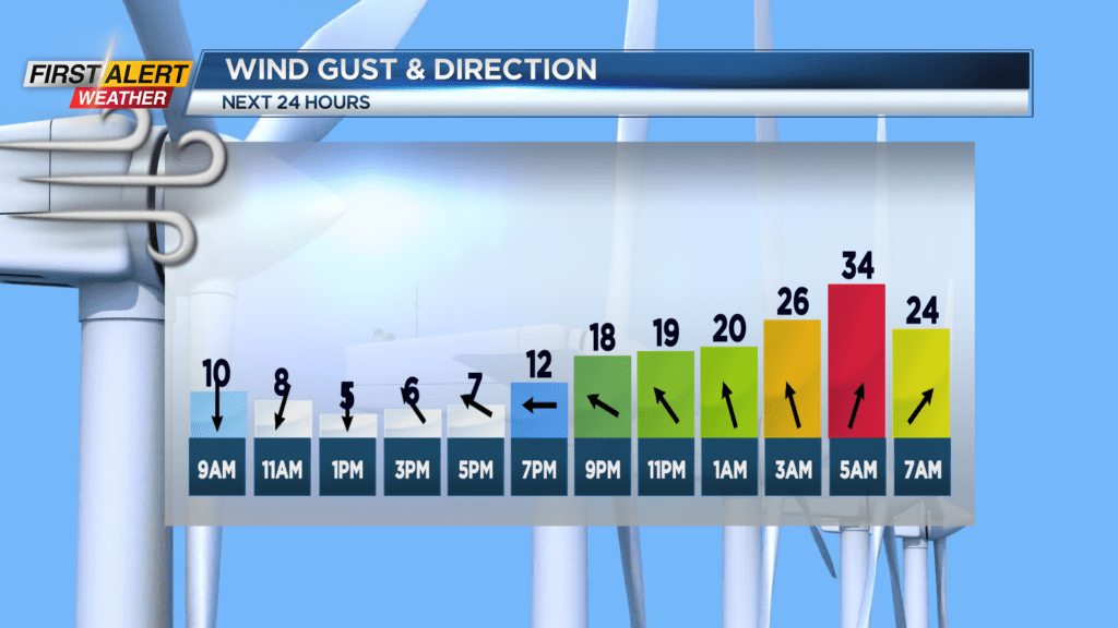
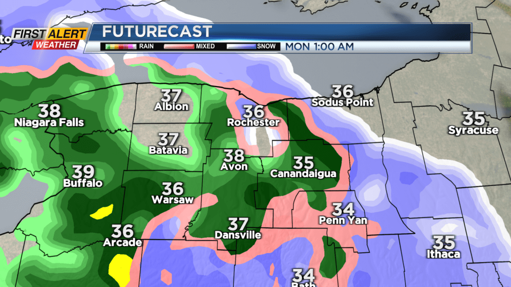
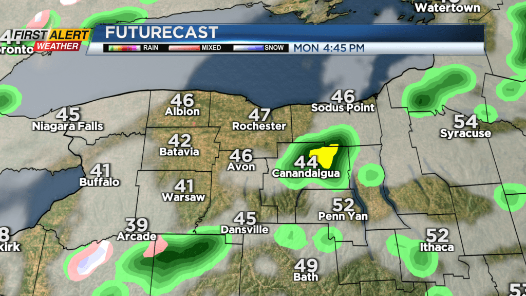
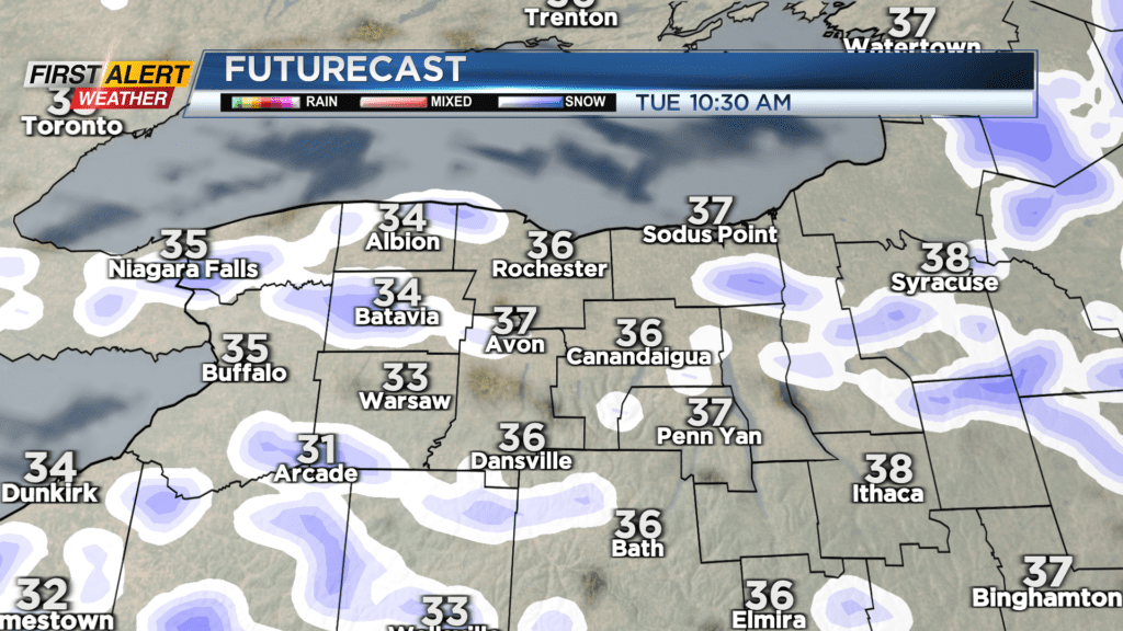
A large-scale circulation pattern will park over the northeast to start out the workweek, bringing strong winds and rain showers on Monday and snow/mixed showers on Tuesday. Wind gusts on Monday may reach 40 MPH in some spots between Niagara Falls and Rochester, but most other places will top out at 35 MPH. Only a few tenths to a quarter inch of rain is expected. Tuesday’s precipitation will be a matter of elevation. Snow showers are more likely down by the Finger Lakes, while lower level areas along the Genesee Valley will get some rain or a rain/snow mix. Snowfall totals will be nil to a coating for most, but some areas down south could get up to an inch.
Mixed showers get the chance to continue into Wednesday morning, and then we are tracking another weak system moving through possibly on Thursday. Stay tuned to News10 NBC to see how that forecast develops.