First Alert Weather: A pleasantly mild morning soon to become unpleasant
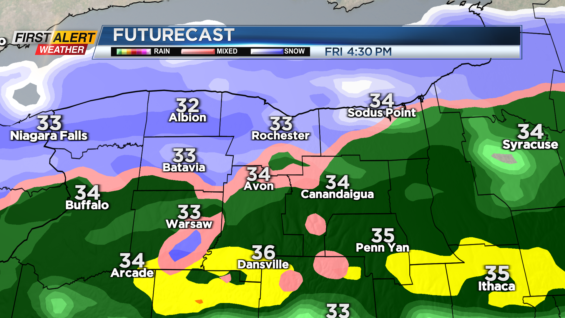
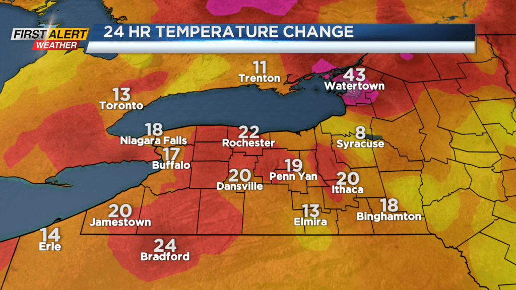
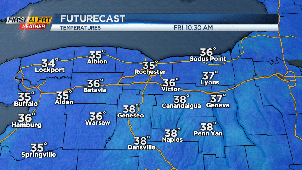
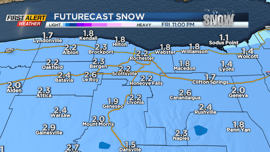
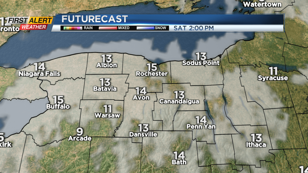
ROCHESTER, N.Y. Western New Yorkers woke up today to temperatures running 15, 20, even 25 degrees warmer than yesterday morning (up in Watertown, it’s over FORTY degrees warmer) as southwest winds ushered in some milder, moister air. Unfortunately, with that warmer moisture air means we’re bound to have some precipitation today. We’ll be getting both flavors – rain from around 7am to 3pm, then as winds shift to a more northerly flow, temperatures drop enough for the rain to transition to wet snow, until moving out around 11pm. In total, 1-3 inches of the slushy stuff will fall, with the heaviest snow falling south of the Thruway. Temperatures are already starting to rise a few degrees above expected — we cracked 40 degrees just before 6am, and we’re expected to dip a little before reaching the high 30s again later this morning.
As temperatures begin to plunge ahead of a much colder Saturday, watch out for icy spots on the road if you’ll be driving tonight, especially after 8pm when temperatures begin to fall into the 20s. We’re currently green on the Threat Tracker as the heaviest impacts are looking to happen after the evening commute but be careful if you’ll be out driving in the later, colder hours.
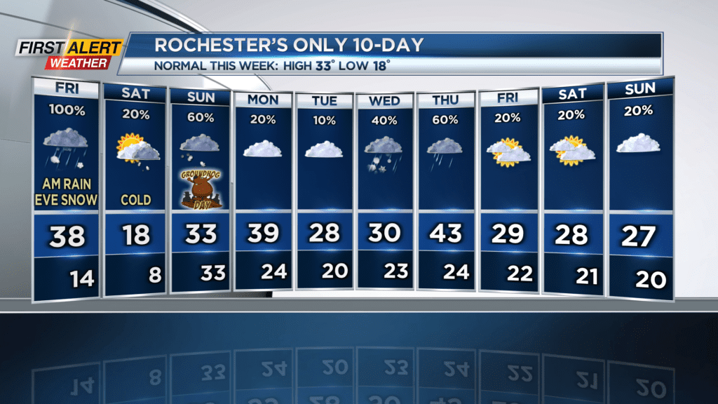
As mentioned above, Saturday is going to be COLD… Temperatures in the Flower City won’t get above 15 degrees, as a patch of higher pressure and drier air nudges in. Wind gusts will be in the 10-20 MPH range (lessening as the day goes on), which will make it feel like the single digits. The good news is it won’t be overcast; that high pressure will help us out a little bit to dissipate those low clouds and give us a peek of sun.
Temperatures will remain chilly for Groundhog Day, with the morning air being in the high teens and the afternoon rising to the high 20s. Clouds will dominate until we get another round of snow from 4pm to around 10pm, and then temperatures will begin to rise going into Sunday, all the way up to the high 30s once again.
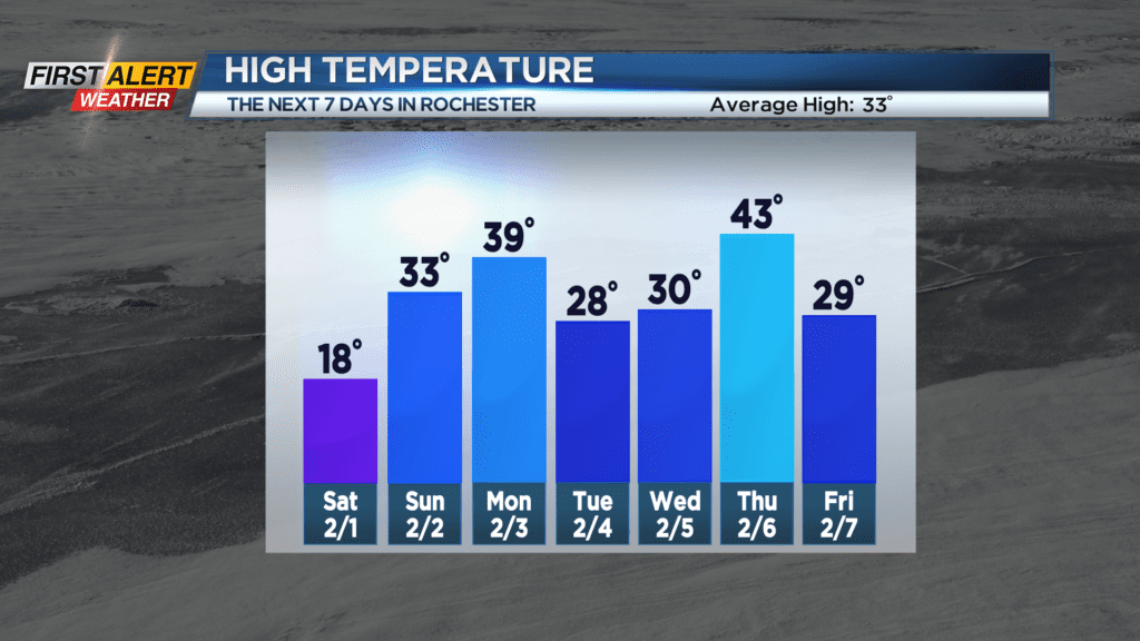
The Temperature Rollercoaster keeps a rollin’ through the rest of next week, with another two dips into the 20s with a jump up into the 40s in between. It seems the freeze-thaw cycle is here a little early, and the long-term temperature trend for February is looking like it will lean a little above normal… Perhaps an early spring is in our future? We’ll have to wait and see. I’m looking at you, Punxsutawney Phil!
Stay tuned to News10 NBC for all your First Alert Weather updates.