First Alert Weather: Another day of chilly flakes but a dry weekend lies ahead
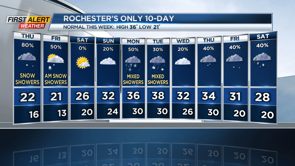
ROCHESTER, N.Y. — We’re in store for snowflakes on Thursday and Friday before finally getting a break this weekend.
So far, there’s only been one day this entire year where we didn’t get any amount of snow, which is a huge turnaround compared to the winters of the last two years.
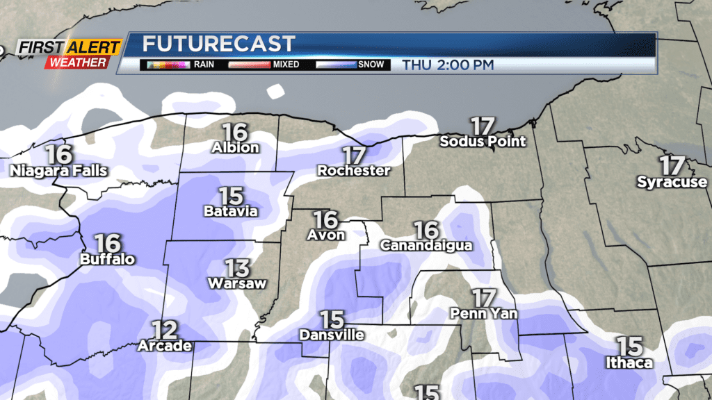
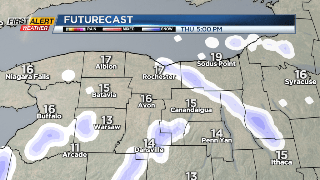
Snow will be area-wide today thanks to a weak disturbance moving through, with snowfall totaling 1-3″ by Friday morning. Flakes are light, fluffy, and moving from west to east on Thursday morning, and no major impacts are expected for the morning commute. A more stringy lake effect pattern sets up this evening, which could cause minor impacts for the evening commute, but for now we remain Green on the Threat Tracker. Temperatures will be very cold, getting up to 20 degrees, and the wind will make things feel even colder at a teeth-chattering 7 degrees.
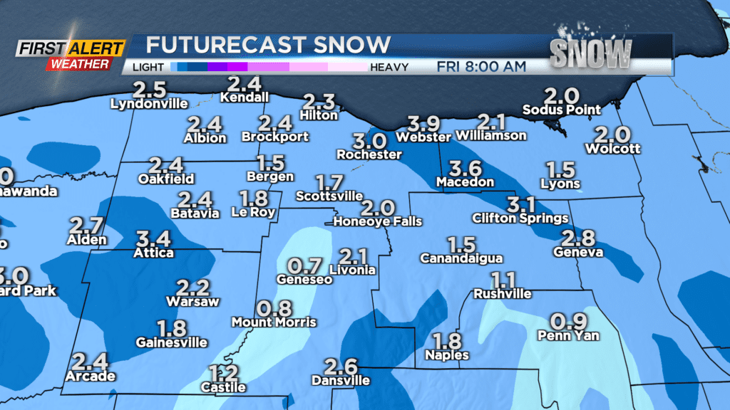

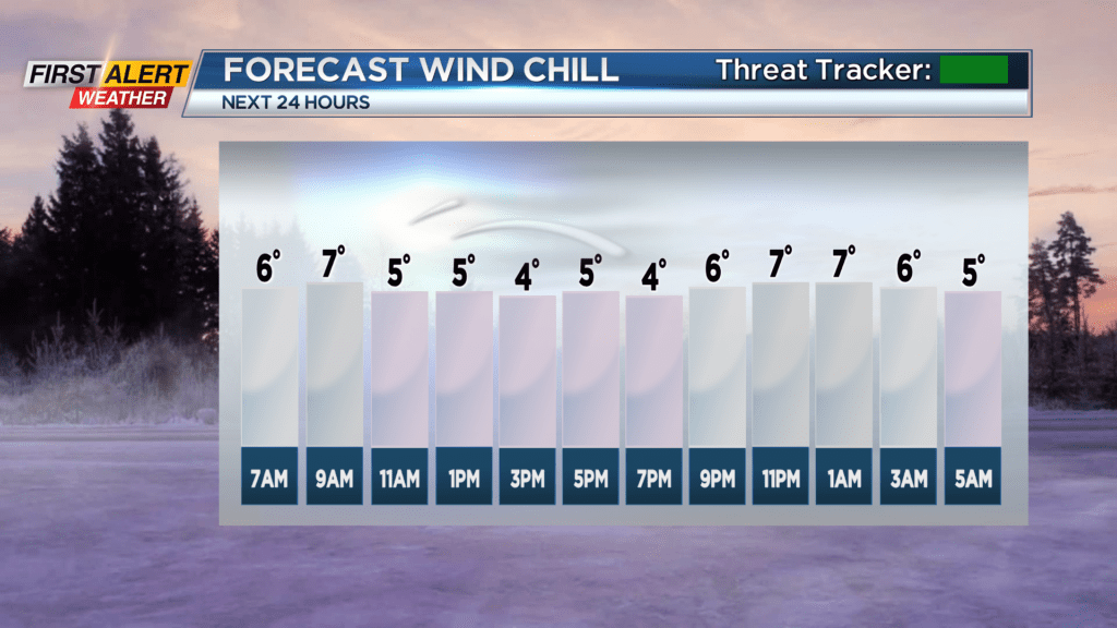
On Friday, the stringy lake snow continues and will be on and off throughout the day, as winds shift from northwest to a westerly flow. Another inch or so is expected, and temperatures again will be in the low 20s. Winds will pick up, gusting to 30 MPH which will cause wind chill values around zero in the morning and up to about 10 degrees in the afternoon.
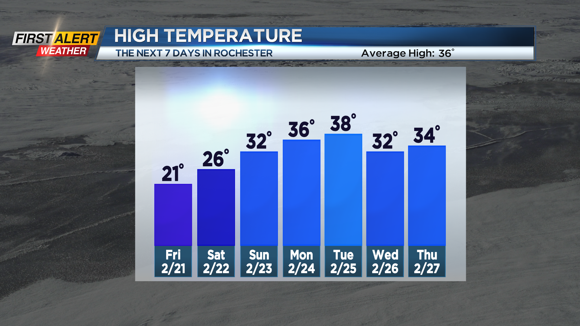
We finally get a break in the snow this weekend as high pressure moves in, promoting partly cloudy skies on Saturday and keeping Sunday dry. If the average cloud cover on Saturday goes below 50%, it will be the first time since December 14th. Temperatures stay cold, albeit a little less cold than today and Friday, with highs in the lower 30s.
Temperatures will continue to climb over the next seven days, possibly even reaching up to 40 degrees next Tuesday. However, this rise in temperatures will not be without some ugly weather, with a mix of rain and snow expected in the first half of next week.
Stay tuned to News10 NBC for all your First Alert Weather updates.