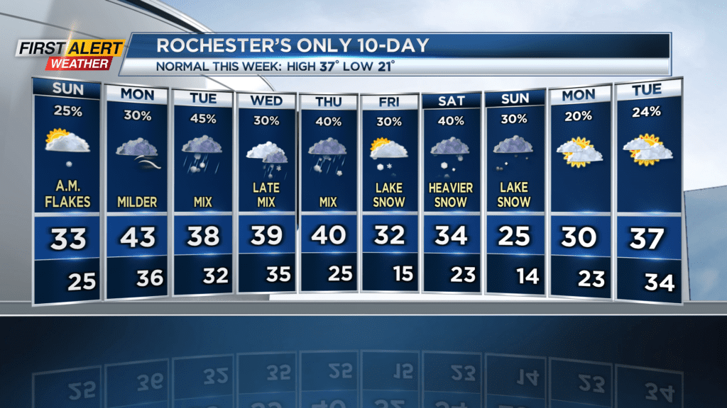
First Alert Weather: Cloudy skies return for Sunday, and a very active week ahead

Milder southwesterly air will mix with multiple low pressure systems coming in from Canada this week to give us mixed precipitation.
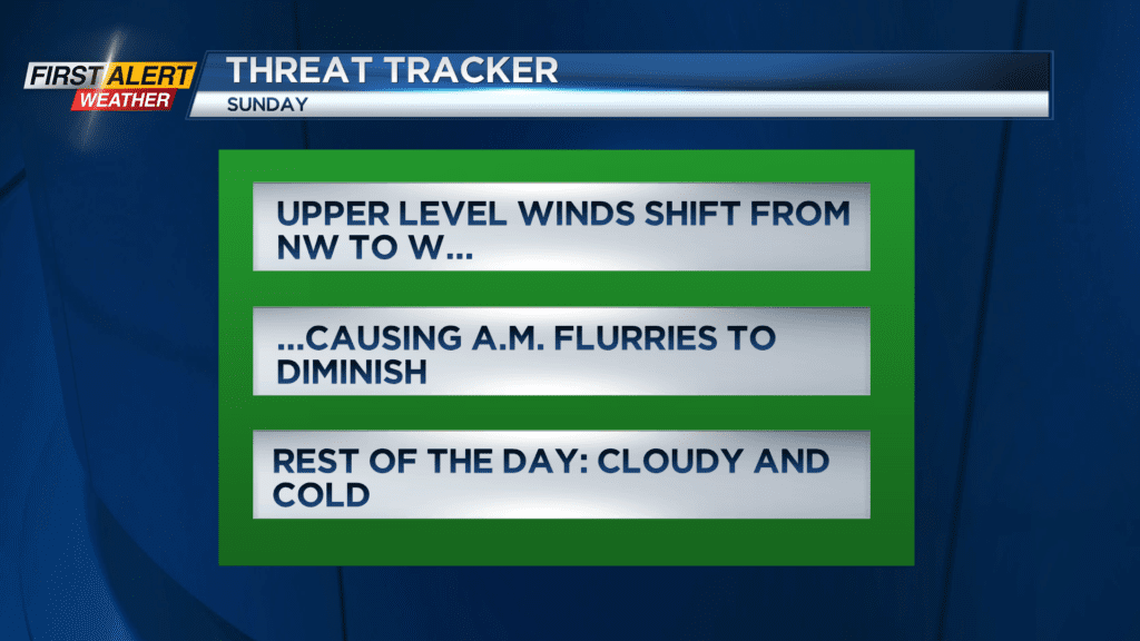
ROCHESTER, N.Y. After a nice sunny winter day yesterday, we’re back to grey skies and lake flakes. The good news is, as upper level winds shift to a westerly flow, that snow will focus in on the Tug Hill region and leave us flake-free for the rest of the day. There may still be a few stray snow showers going into the late morning, but other than that, expect cloudy skies and temperatures in the low thirties.

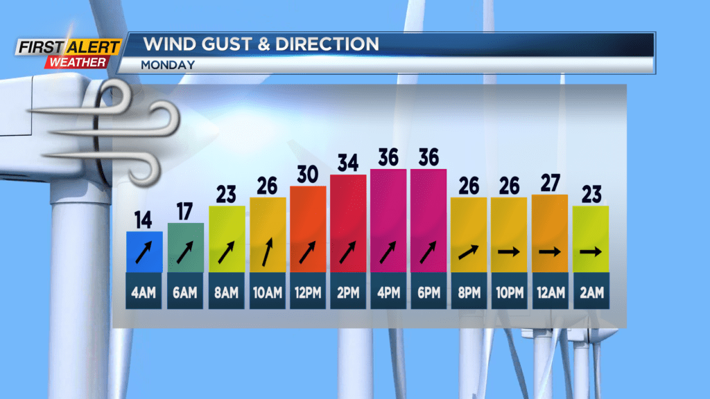
Starting tomorrow, our weather pattern begins to flare up. Temperatures will rise all the way up into the 40s as milder air flows in from the southwest, but a fast moving clipper system passes to our north which will give us the chance at some rain and strong winds.
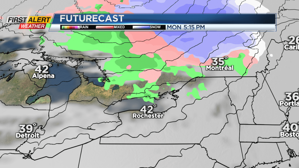
We will receive multiple systems like this over the next ten days, and the ratio of rain to snow will depend on the temperature gradient and exact position of the storm centers. Either way, we’ll be seeing plenty of precipitation. For the times we get snow, not a lot of accumulation is expected, only about 1-2″ at most. And the warm temperatures ahead of the precip plus the chances for rain will likely wash away most of that snow. Friday through Sunday could see both lake effect and widespread snow, but that’s too far out to make an exact call on. We’re continuing to track this very active pattern and will keep you updated.