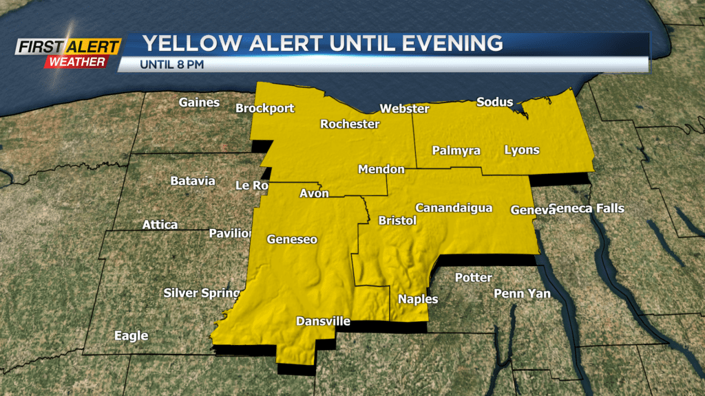
First Alert Weather: Downpours the greatest threat
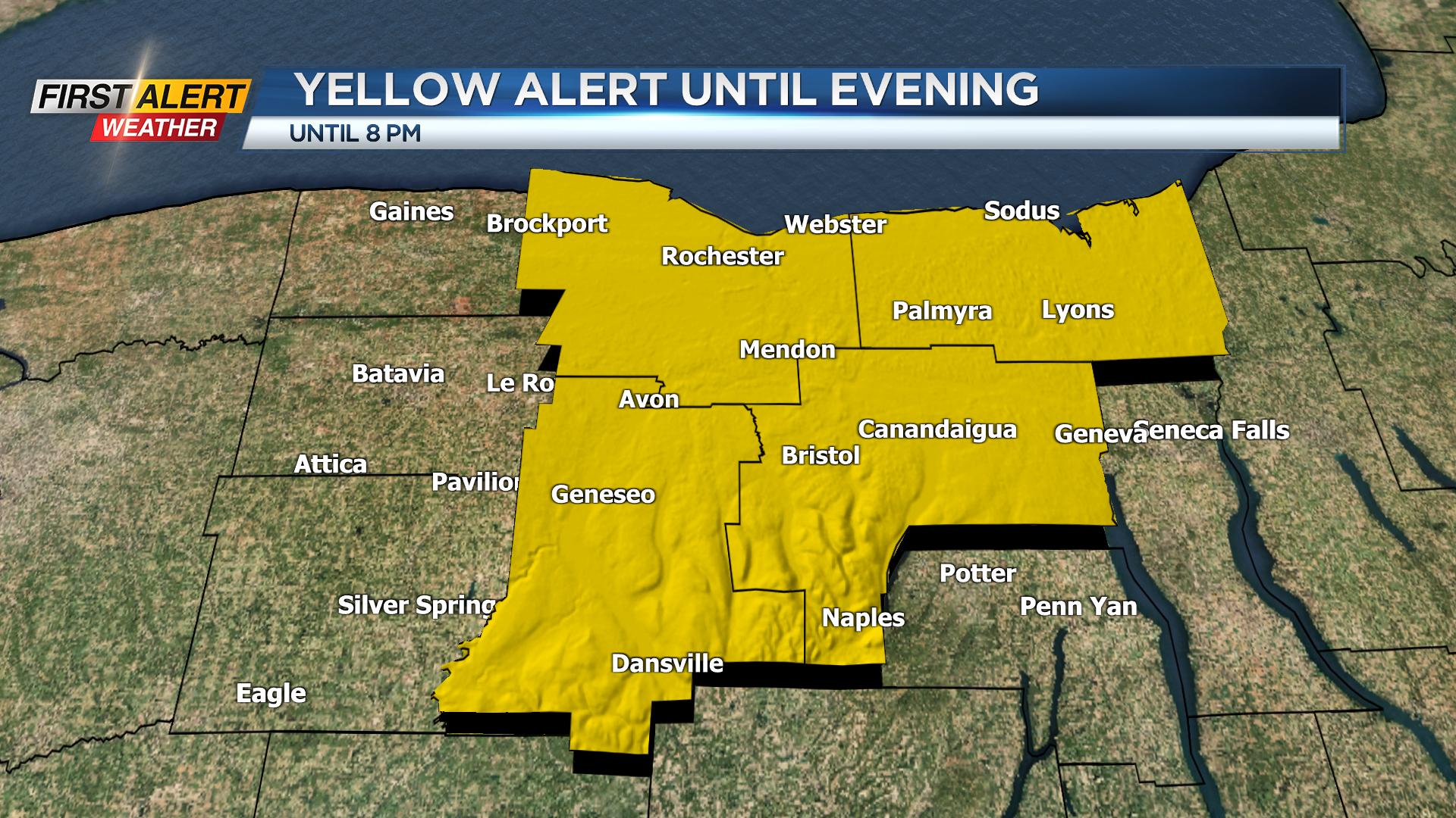
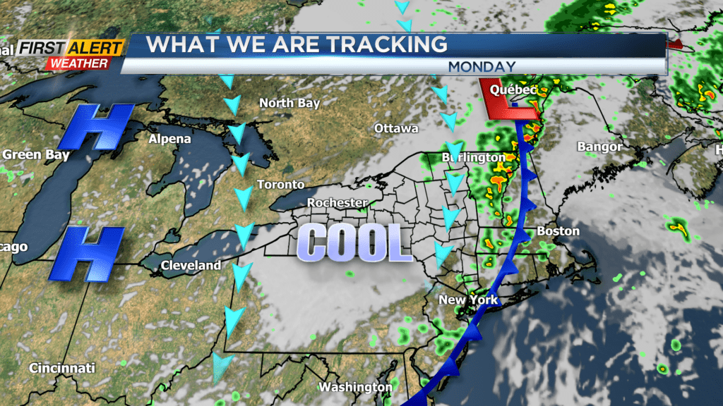
News10NBC First Alert meteorologists are tracking a large, vigorous low-pressure system located over the central Great Lakes. There will be periods of dry weather, but as the storm slowly pushes east there will also be occasional showers and thunderstorms. Due to the high level of humidity, the greatest threat will be localized downpours because of slow-moving storms. As a result, we will be looking the potential for flooding and ponding on area roadways through the next 24 hours.
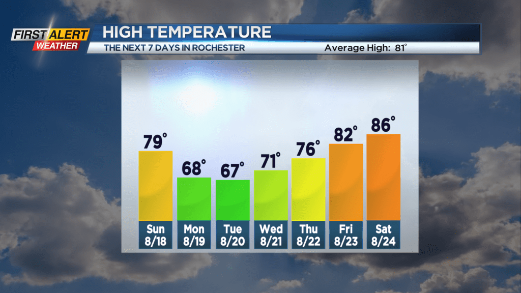
Saturday night, look for occasional showers with imbedded thunderstorms. It will be a muggy night with the low temperature in the upper 60s. Sunday brings another round of showers and thunderstorms with the greatest likelihood around the late morning into the middle of the afternoon. The high temperature will be near 79 degrees. More showers are likely for Monday, and it will turn much cooler. Most of the day will remain in the upper 60s. Finally dry, comfortable weather with more sunshine returns for Tuesday and Wednesday.
Stay tuned to News10NBC First Alert weather for updates on the forecast.