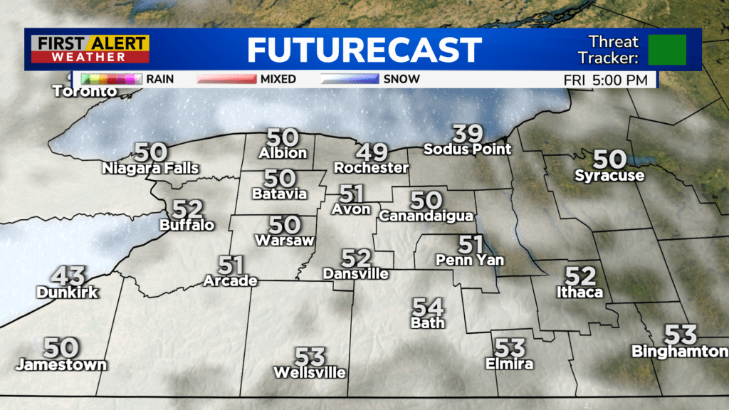
First Alert Weather: Fair weather Friday before rain returns this weekend
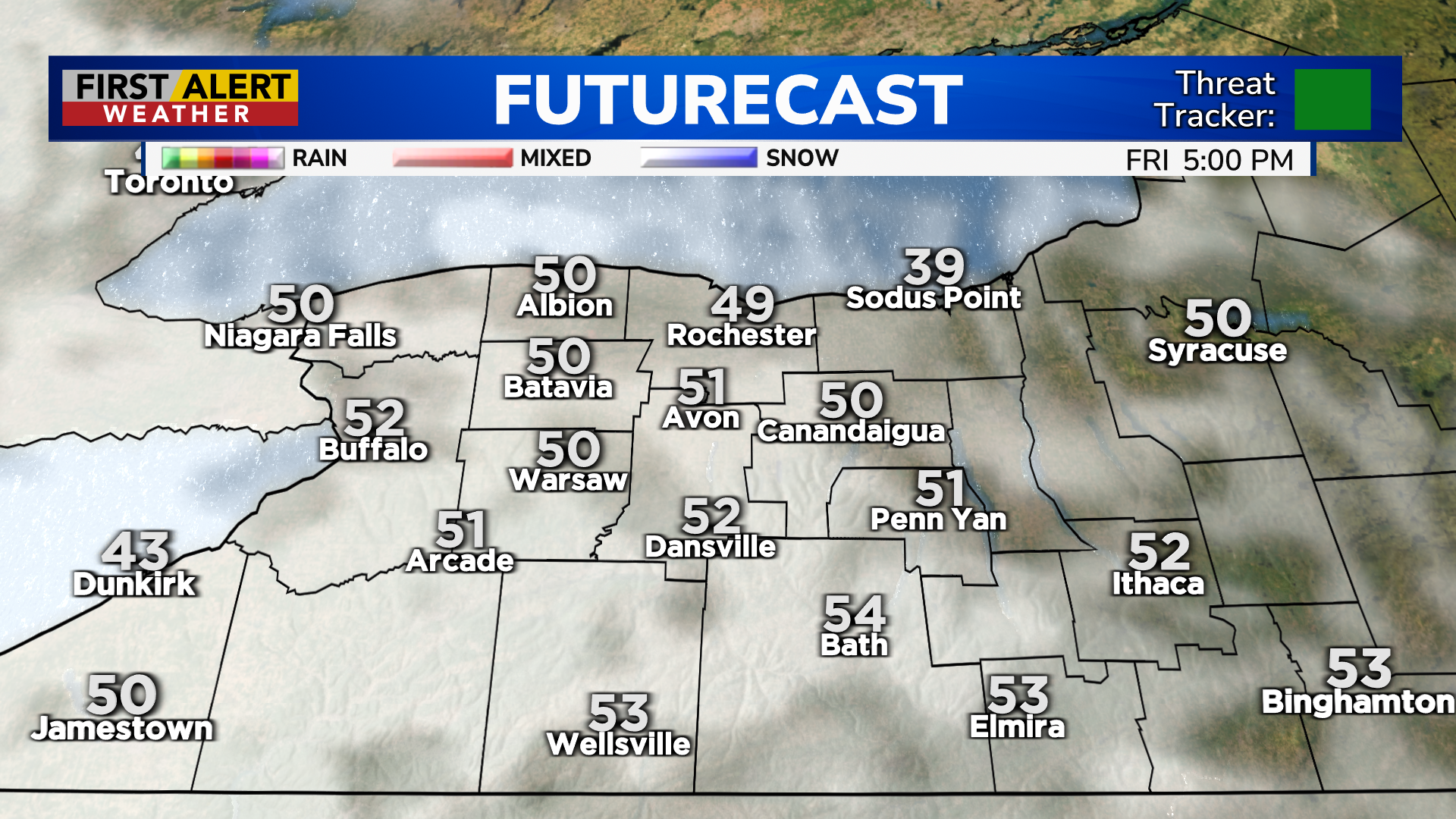
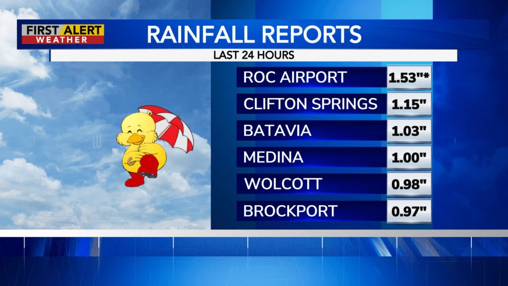
ROCHESTER, N.Y. – If April showers bring May flowers, then we should see vibrant colors in a month! Our most recent bout of rain Wednesday into Thursday morning brought a record for daily rainfall at the Rochester airport, recording more than an and a half of rain. This broke the old daily record for Wednesday’s date. On the plus side, we’ll continue to dry things out with dry weather and seasonable temperatures on Friday.
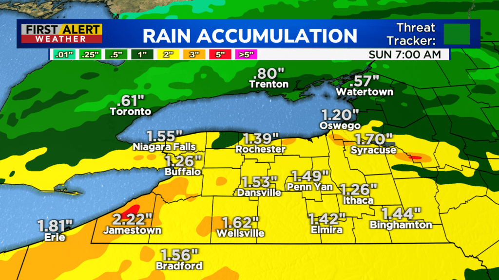
Our next storm system arrives just in time for the weekend, with our first round of rain greeting us Saturday morning. We’ll likely see a lull, which should allow temperature to climb through the 50s. Another round of rain will likely develop later in the afternoon and evening with the approach of a cold front. Rain will continue into early Sunday morning, before tapering. We may see another inch or so of rain in some spots this weekend. It is a good idea to make sure sump pumps are working properly. Rain will taper Sunday morning, so we’ll begin to dry out for the second half of the day.
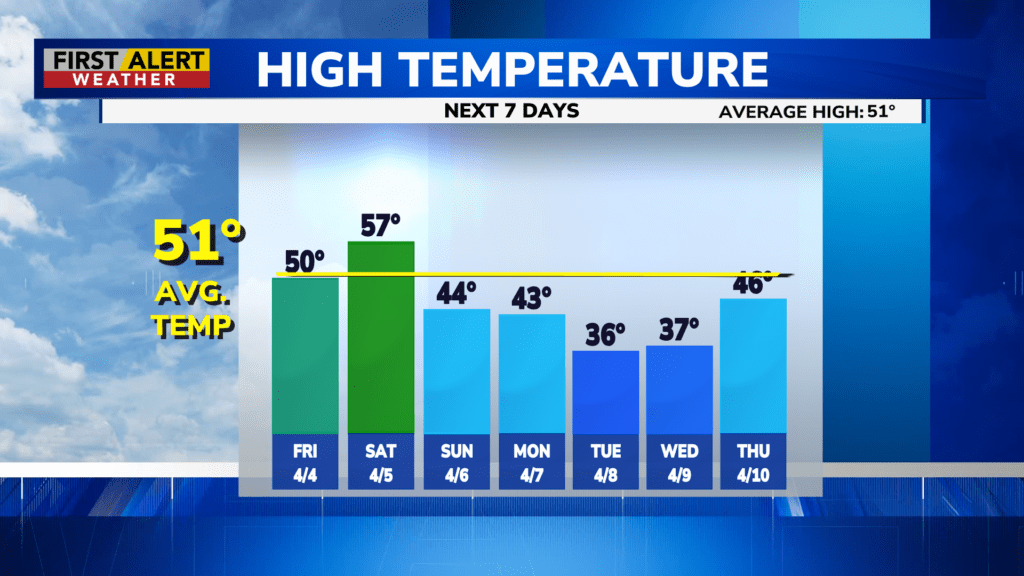
Then it’ll start to turn cooler into next week. Highs will hold in the lower 40s on Monday, and likely stick in the 30s on Tuesday and Wednesday. A fast moving system will deliver a little bit of snow Monday night into Tuesday, followed by some lake flakes on Wednesday. Amounts will be minor, with most areas only picking up an inch or so.