First Alert Weather: Finally, a break in the snow!
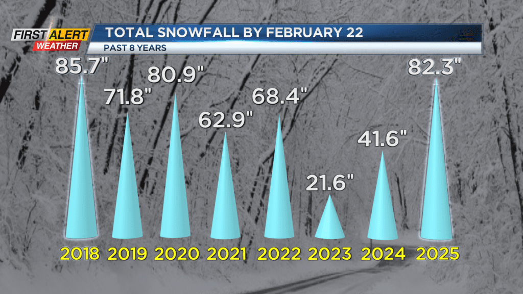
ROCHESTER, N.Y. For the first time since January 10th, and only the SECOND time this year, the Rochester area will be flake free. We got around 2″ of fluffy light flakes yesterday, which brings our snowfall total for the season up above 80″. This is now the snowiest winter we’ve had in seven years… A huge turnaround from the last two winters which can best be described as duds.

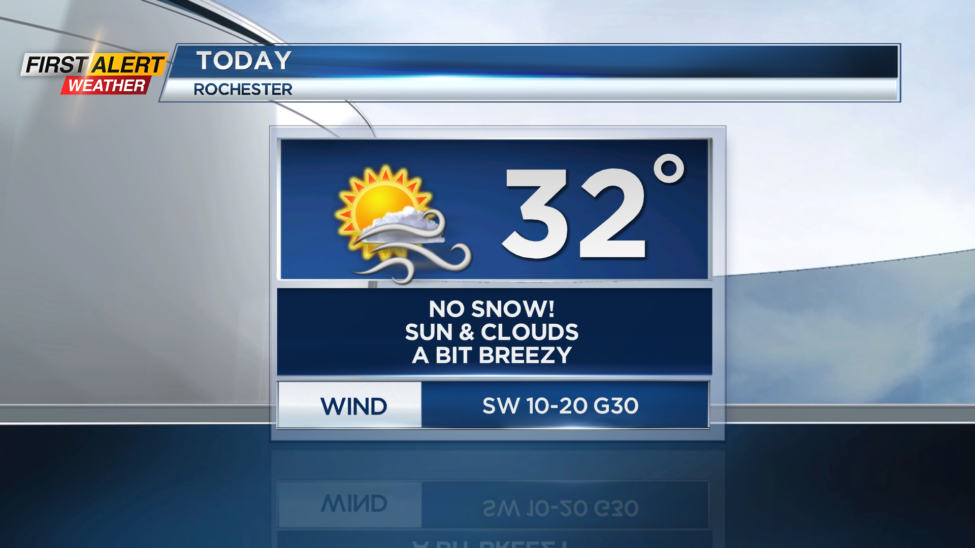
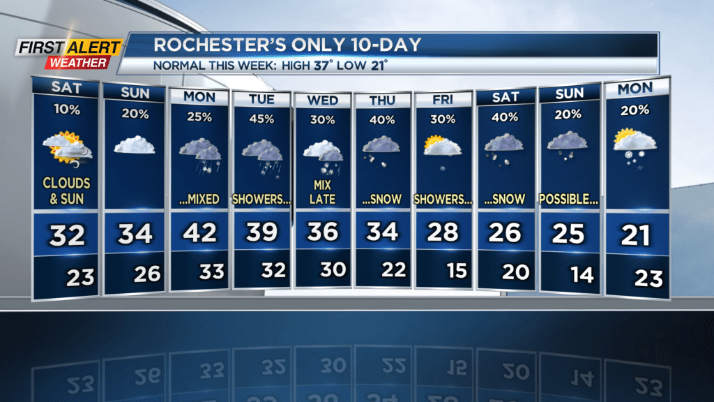
While we’ll get to enjoy some sun, it’s still going to be a chilly day. High temperatures will hover around freezing level, and winds coming out of the southwest at 10-20 MPH will make the air feel like the low 20s.
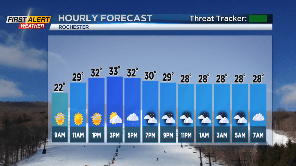
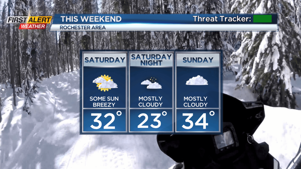
The clouds return this evening and last through the rest of the weekend. There’s a slight chance of passing flakes tomorrow, but nothing that will accumulate. Temperatures will get up to the low 30s again, but not warm enough to melt much ice and snow…
Our winter weather pattern very quickly becomes active again next week. There will be chances for temperatures to rise to near or just above 40 degrees, which sounds nice, but unfortunately that will be due to southwest wind bringing up milder and moister air ahead of several weak clipper systems. That means rain and snow — several times this week. We’re closely tracking the specific timing of these weak systems, but they shouldn’t be anything that will have major impacts on travel. There is the possibility of a bigger storm next weekend, but that’s still a ways out, so the forecast is subject to change.

But for now, make sure you get out and enjoy this rare break in the snow and healthy dose of sunshine! Stay warm!