First Alert Weather: Lake flakes continue to fly into Friday
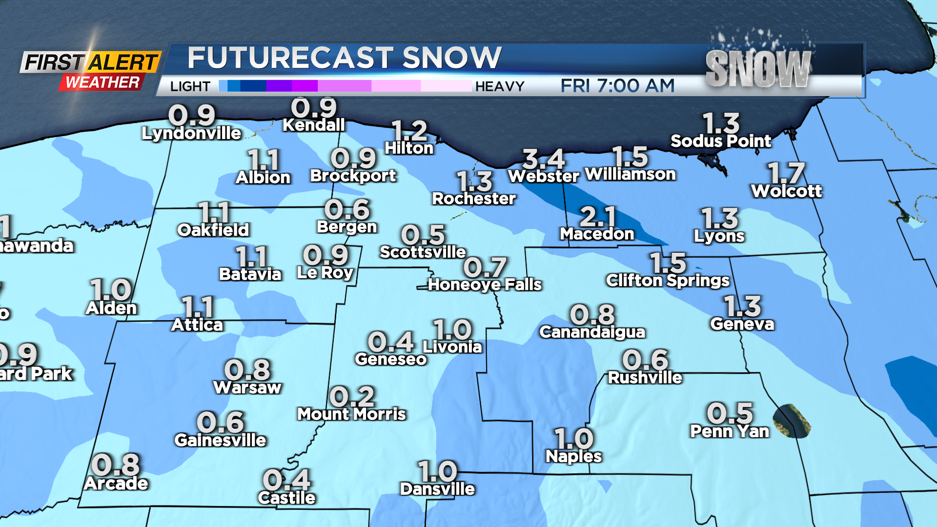
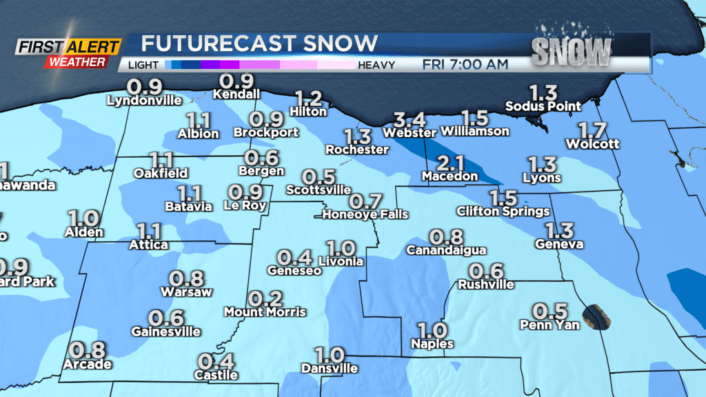
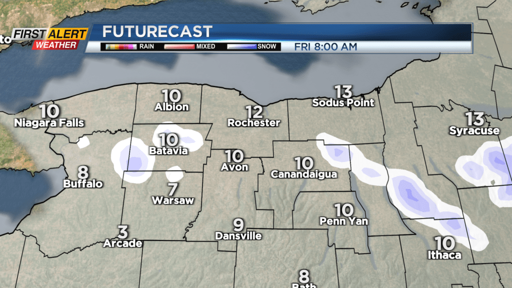
ROCHESTER, N.Y. – We kept our streak of consecutive days with snowfall going on Thursday, with another batch of area-wide snow, which will be transitioning to some lake effect snow Thursday night and into Friday. Most areas will only see another coating to an inch or two before things wind down, but there will be some towns where the lake snow remains stubborn, that see another 3-4″ of fluff before the snow finally tapers later on Friday. This won’t have much of an impact on the roads or commutes, but it does mean we’ll have to take a few minutes to clear the cars once again on Friday morning. Friday will turn blustery and remain cold, with wind chills in the single digits much of the day.
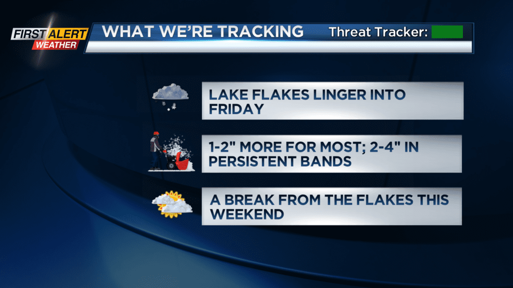
The weekend may feature only our second day since the start of 2025 without any flakes at the Rochester Airport! At least that is how it is looking now, with high pressure building in, shutting down the lake snow, and bringing a return to some sunshine at times on Saturday. The clouds return on Sunday, and outside of a few flurries, we shouldn’t see any accumulating snow.
We’ll begin to “warm” things up a bit next week, with temperatures in the upper 30s on Monday and Tuesday, allowing our next batch of precipitation to fall as rain and some wet snow. No accumulation is expected at this point through mid-week, but that could potentially change by Thursday. Another stronger storm moving in could start off as rain, and possibly end as some accumulating snow, followed by another punch of chilly air. This is still a little less than a week away, so at this point we’ll just monitor the trends.