First Alert Weather: One more day of snow then finally a break this weekend

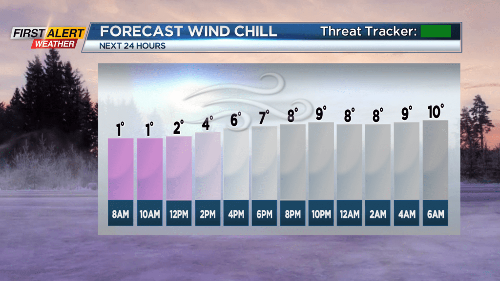
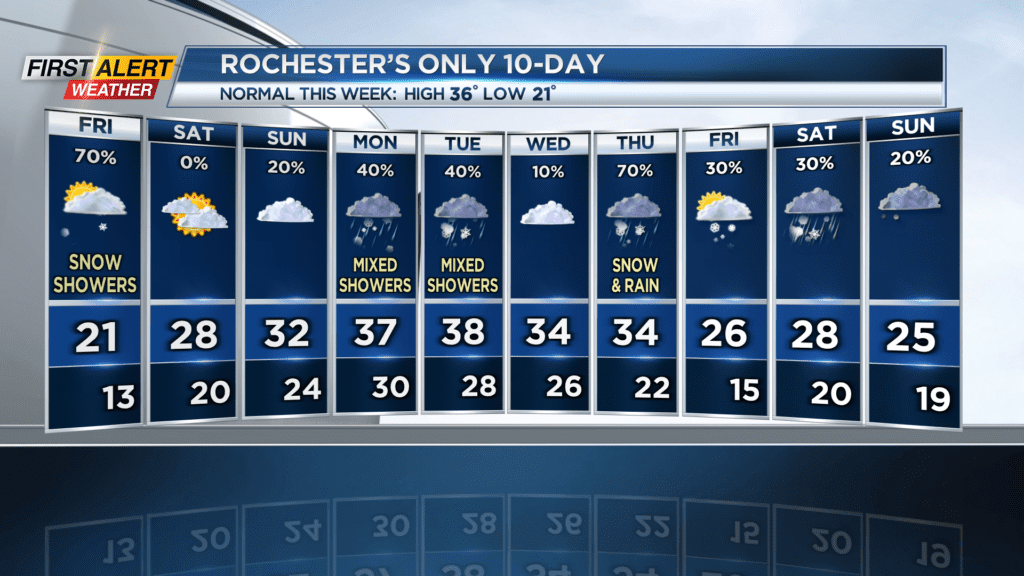
ROCHESTER, N.Y. After 51 days of snow out of 52 this year, we’re finally getting a break… Tomorrow. We’ll see another round of lake effect snow today, with most areas only seeing a coating to an inch. Some local spots may get an inch or two more of fluff. Snow generally will be moving west to east, as wind shifts from northwest to west. Temps will be in the low 20s, and blustery winds will make things feel like the single digits; this will be the case especially in the morning, when wind chill values will hover just above zero degrees.
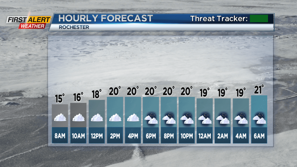
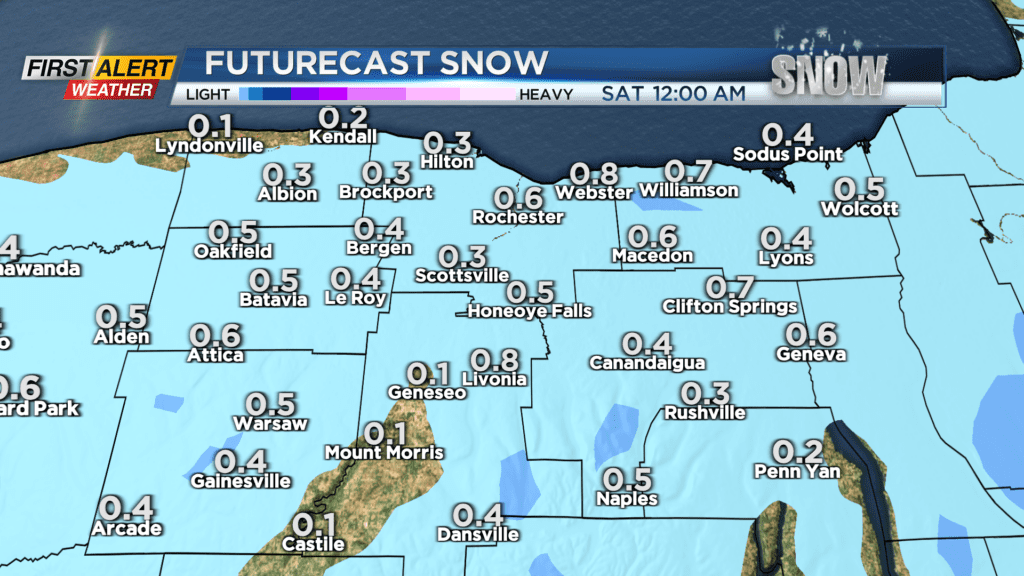
Lake snow will taper off going into the afternoon. Due to a good portion of Lake Erie being completely frozen over, west winds are not able to produce as much lake effect snow coming from that direction, so from this point on the “lake effect snow machine” will be at the mercy of the north and northwest winds. Since the winds will shift from northwest to west today, the snow will eventually scurry off.
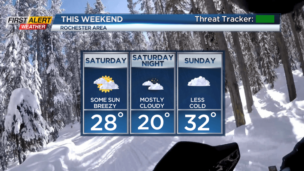
A patch of higher pressure will move in over us on Saturday, which means we’ll finally see a day without snow for only the second time so far this year. In fact, we’ll see a good amount of sun; we may even reach mostly sunny status over the course of the day. The last time we had an average cloud cover below 50% over the course of 24 hours was on December 14th. It’ll still be cold however, with temperatures hovering around freezing level, and winds will continue to be a nuisance with gusts up to 30 MPH, bringing wind chill values down to the low 20s.
Sunday has the chance to see a little snow late (nothing that will accumulate), but for the most part it will be a cloudy and less chilly day with highs in the mid 30s, with winds coming out of the southwest at 15 MPH.
Temperatures continue to rise going into next week, getting to the upper 30s on Monday and Tuesday, but alongside those rising temps comes some ugly weather. Rain and wet snow are likely Monday/Tuesday, although with no accumulation, and then another round of mixed precipitation is possible on Thursday. The weather pattern remains active, with some possible accumulating snow next weekend, but we’ll monitor that system over the next few days to see where it’s likely to land.
Stay tuned to News10 NBC for all your First Alert Weather updates.