First Alert Weather: Rain and snow with another clipper
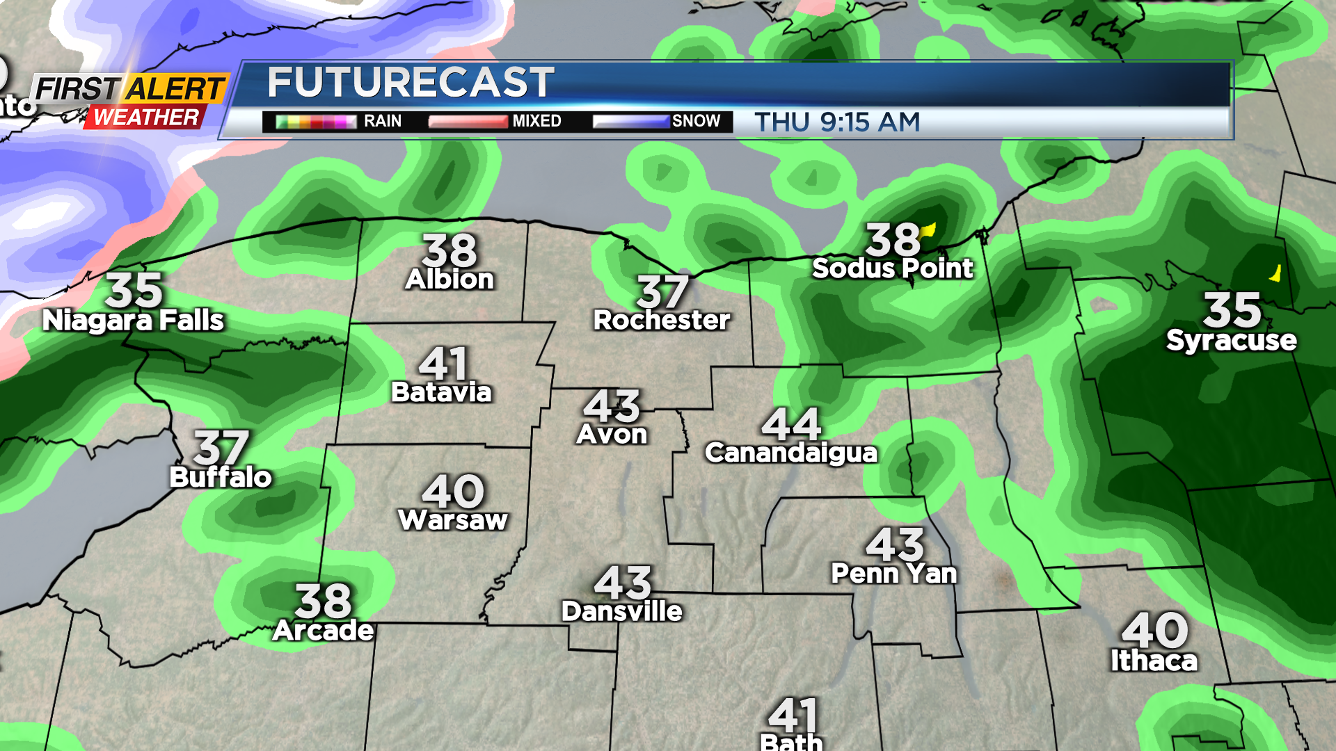
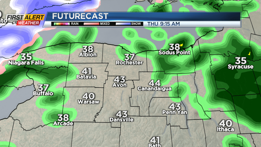
ROCHESTER, N.Y. – The first of two more clippers impacting the region arrives Wednesday night, with a mix of rain and wet snow showers, changing over to rain showers overnight as temperatures actually rise. That climb will be short-lived, with temperatures slowly falling back through the 30s once again on Thursday. This will change any rain showers back over to a mix of rain and wet snow showers by late Thursday. No new snow accumulation is expected through Thursday evening.
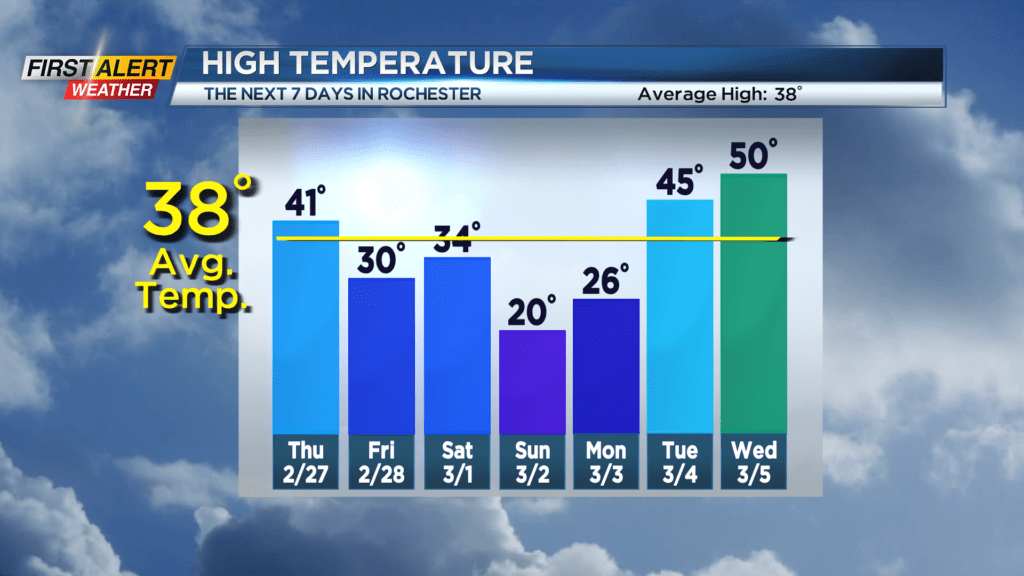
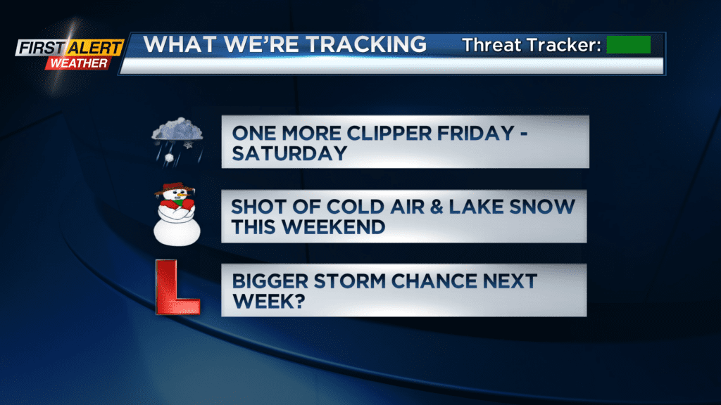
We then transition over to some brief lake effect snow showers Thursday night into early Friday. Once again, any accumulation will be minor, if anything at all. Friday will start and end with some light flakes, with a little bit of sunshine sandwiched in the middle. The light snow arriving Friday night is associated with our last clipper of the week, and may produce a coating to an inch or two Friday night, before once again changing over to some rain and wet snow mixed. This will last into Saturday morning, before temperatures drop again. Winds pick up and we’ll see a minor response from Lake Ontario, with some lake snow showers developing again late Saturday into Sunday. A few inches of snow are possible in some spots, but once again, any accumulation should be minor.
We’ll remain cold through Sunday, with some light flakes lingering into early Monday, before high pressure takes over and so does some sunshine! But, we’ll already be tracking our next larger storm system set to arrive by Wednesday. This will draw in milder air for Tuesday and Wednesday with rain, before colder air rushes in and changes our rain over to some snow by Thursday. At this point, no Alert Days are in the the forecast, but the storm track does remain fairly active.