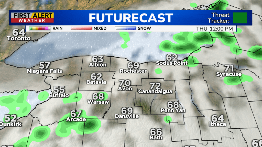
First Alert Weather: Rain on Wednesday, then warmer and windier for Thursday
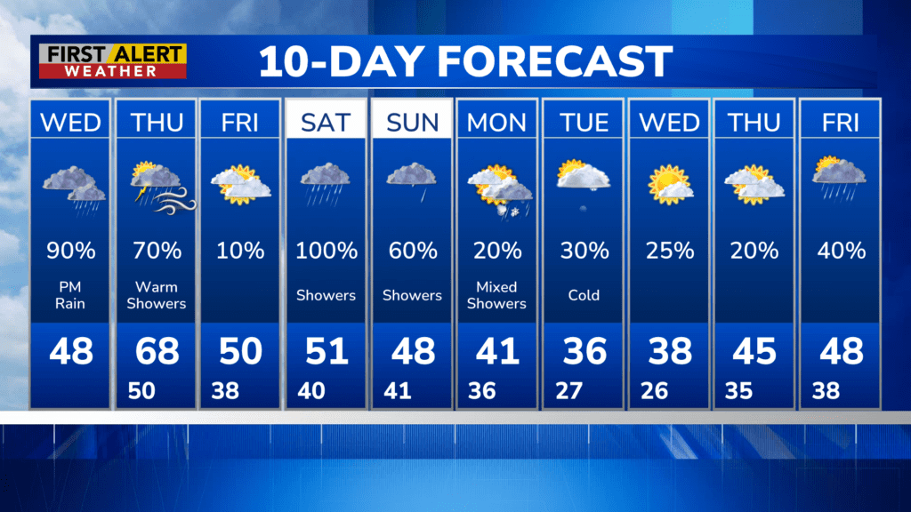
ROCHESTER, N.Y. – Expect slightly warmer temperatures on Wednesday compared to yesterday, with highs in the high 40s and rising overnight. There will also be rain on Wednesday afternoon and winds out of the southeast gusting up to 30 MPH.
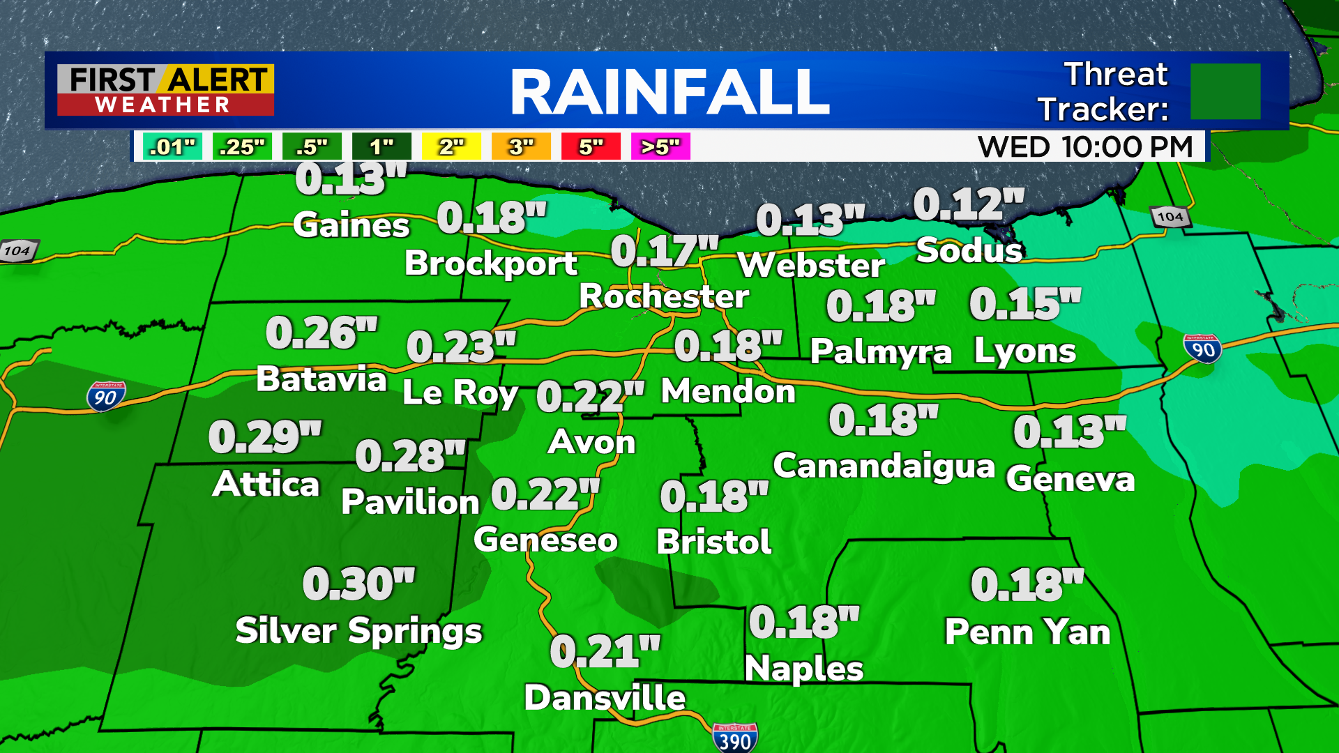
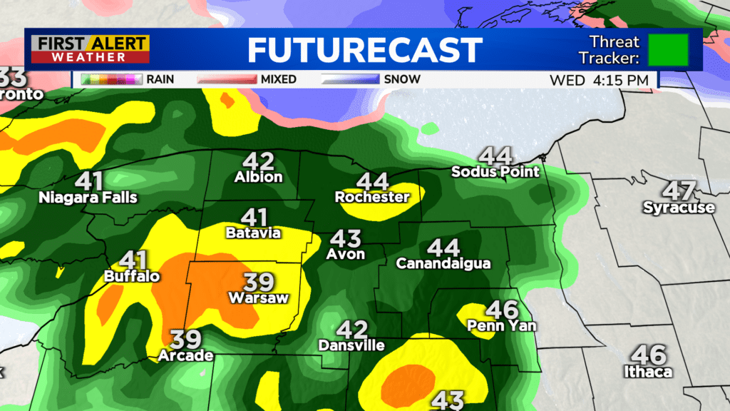
Rain will begin in the mid-afternoon and start to pick up in the late afternoon/early evening timeslot before tapering off in the evening. Rain has the chance to pick back up around 8 or 9 p.m. and weaken again overnight, before picking up once again on Thursday morning. A rumble of thunder is not out of the question overnight and Thursday morning ahead of a cold front.
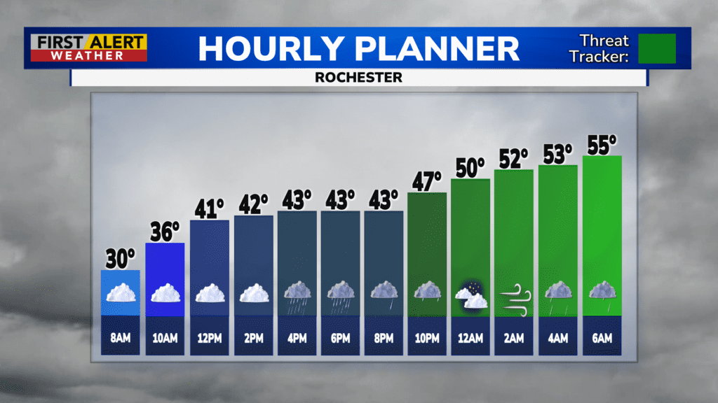
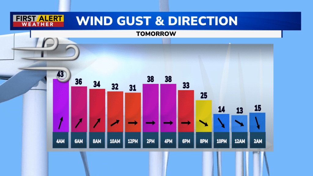
Winds on Thursday will be the much bigger story than any rain or thunder. Winds will pick up and shift southward overnight ahead of a strong low-pressure system, pulling in warm southern air and raising our temperatures steadily.
By 8 a.m., we’ll be up to 60 degrees. Gusts could get up to 45 MPH and 50 MPH in some spots down in the Finger Lakes. Not much mixing in the atmosphere is expected, which will help prevent gusts above 50 MPH from reaching the surface, but the fact that the strongest winds will only be a few thousand feet up means the chance for stronger gusts is still there.
While we remain Green on the Threat Tracker for now, we will continue to monitor these winds and may issue a Yellow Alert if it looks like they’re picking up, so be prepared.
Expect a return to seasonably cool temperatures after Thursday, with rain showers this weekend and even a chance of snow early next week as temperatures dip down into the 30s. Stay tuned to News10 NBC for all your First Alert Weather updates.