First Alert Weather: Six more weeks of winter? Bring it on!
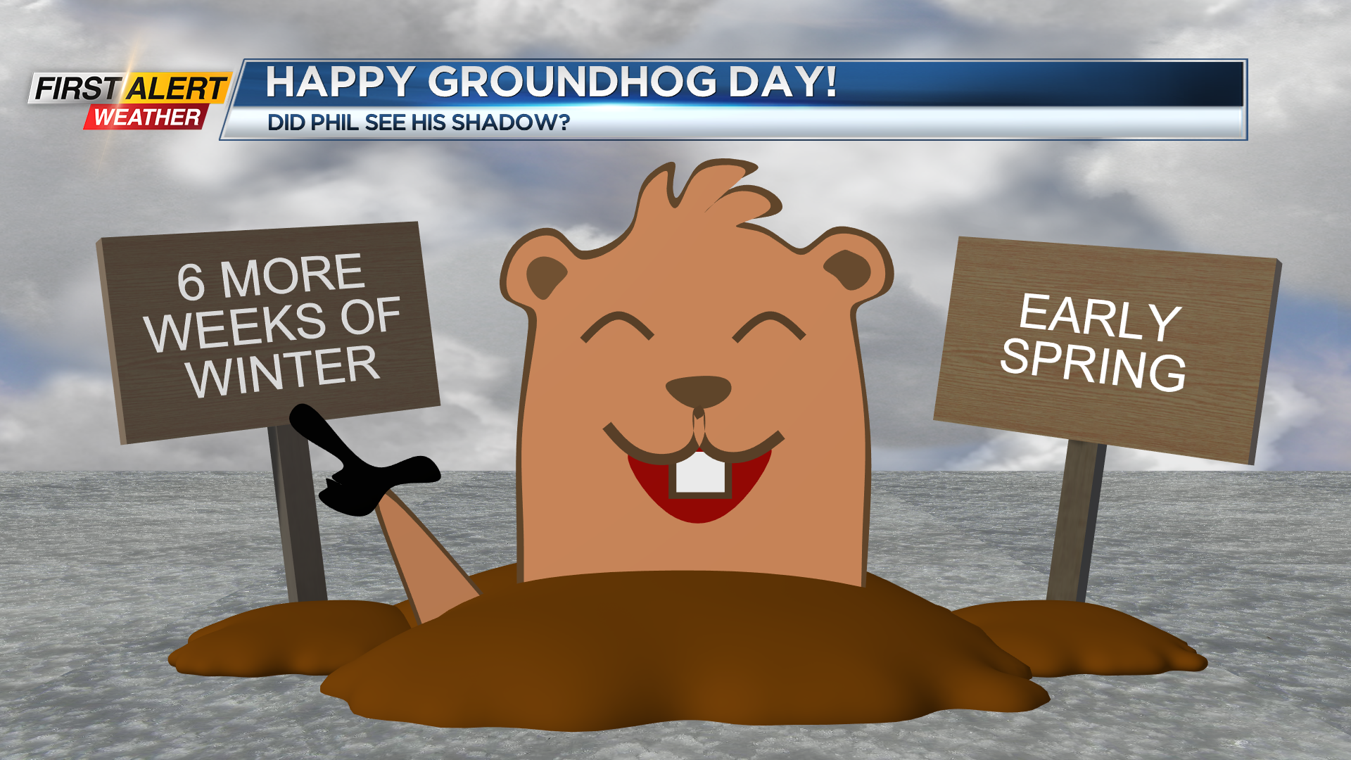
ROCHESTER, N.Y. Well, it’s official! Despite mostly cloudy skies down in Punxsutawney, PA, there was JUST enough sun poking through to be blocked by a certain rodent of the Marmota variety while he was emerging from a tree stump, creating a shadow that ultimately pushes back the start of spring for the next six weeks… Right? Well, it depends where you are in the country, and what your definition of “Spring” is… Above average temperatures are expected for much of the US this February, namely the Southeast. Meanwhile, the northern Great Plains and Pacific Northwest may see below normal temps. Either way, it’s still going to be chilly, as this is February in the northern hemisphere we’re talking about. While astronomical spring begins on the vernal equinox (March 20th), METEOROLOGICAL spring begins on the first day of March. That’s only 4 weeks away… Or, if your definition of spring is simply when it starts to “feel like spring”, well, anything is possible. We’ll just have to wait and see!
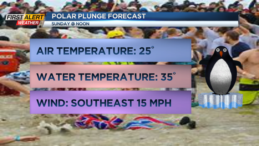
Now, if Rochesterians can jump into Lake Ontario on a freezing day in the middle of winter, I think we can take six more weeks! Happening today is the annual Polar Plunge for Special Olympics New York over at Lake Ontario Beach Park. If you’re fixing to be Freezin’ for a Reason, just know that it’s going to be cold… 25 degrees to be exact. Combined with a southeast wind at 15 MPH, that’ll make things feel like the low teens. The water should be a lot toastier though, at a whopping 3 degrees above freezing… My recommendation is to get in quick, and get out quicker! Also, please remember to bring a towel.
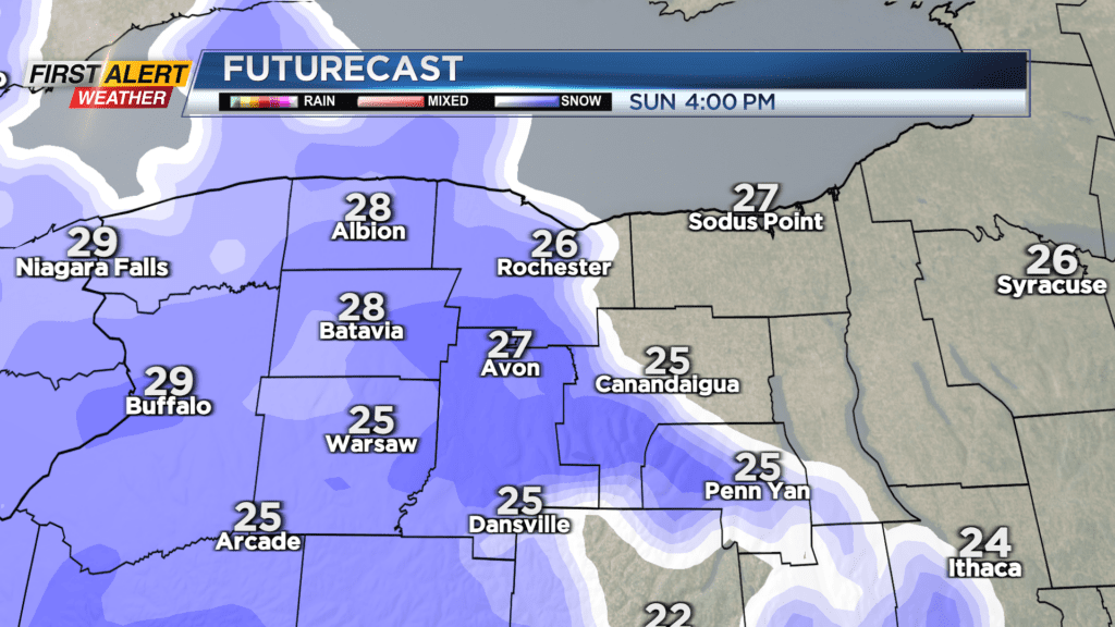
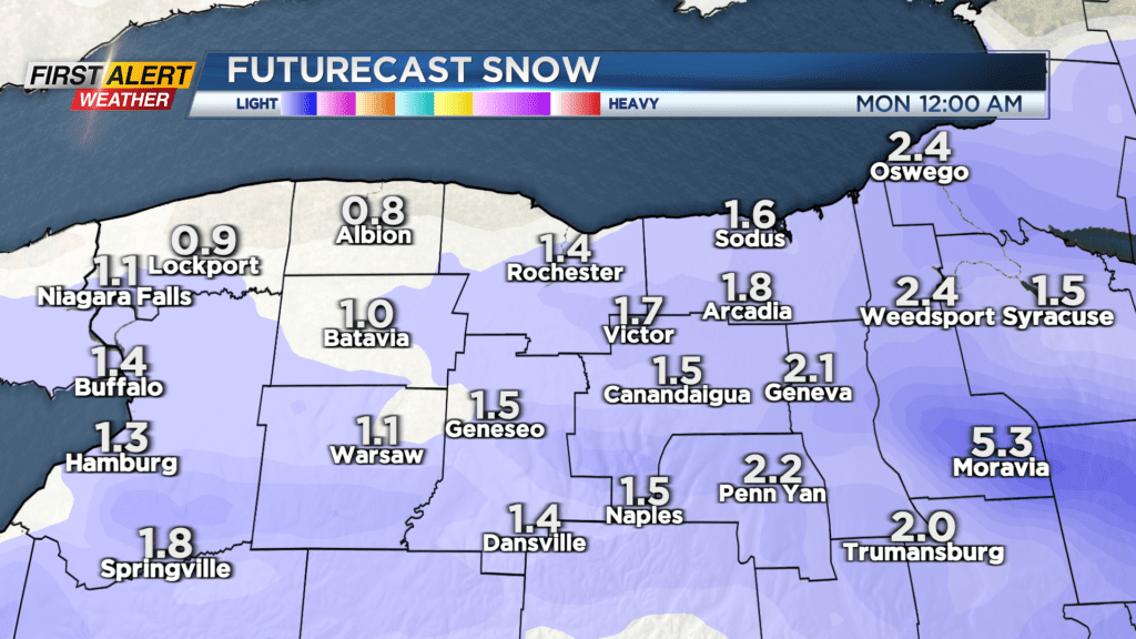
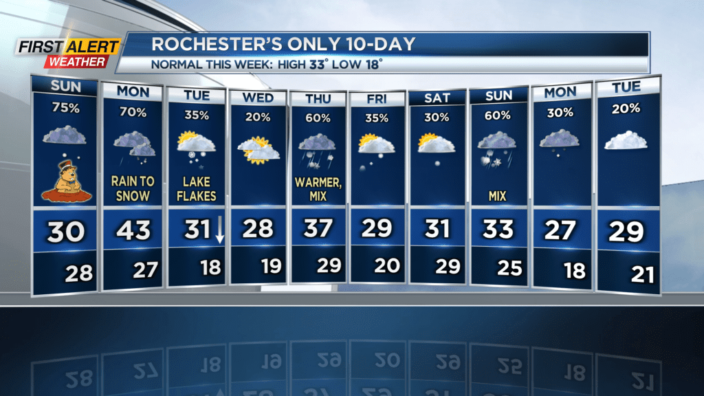
We’re also tracking a little bit of snow that’ll come through the area today… It should get here in the afternoon, around 4pm. It’ll last through the evening, and in total we’ll get about an inch or two, with the most snow being in the eastern counties. Temperatures will begin to rise overnight, reaching 33-35 degrees in Rochester during the Monday morning commute. Although temperatures being above freezing means slick spots shouldn’t be a major issue, still take cautions especially if you are traveling underneath a bridge where more ice can develop.
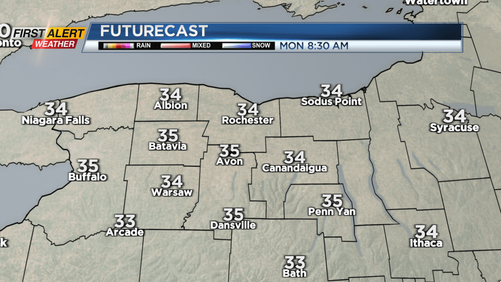
Throughout Monday temperatures continue to rise, leading to some rain in the afternoon that will transition to a mix and snow Monday evening. Afterwards, winds shift to the Northwest, which means we’ll get some lake flakes on Tuesday. There will be a few more chances for mixed precipitation throughout the week, namely on Thursday and next Sunday.
Stay tuned to News10 NBC for all your First Alert Weather updates!