First Alert Weather: Some rain, wind and milder air into Thursday
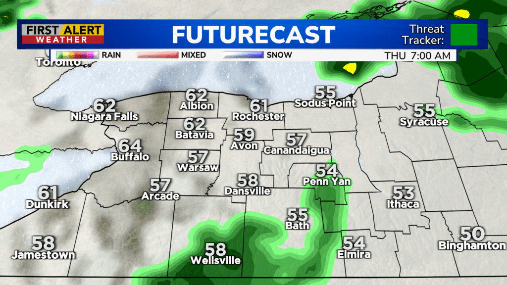
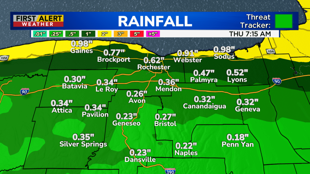
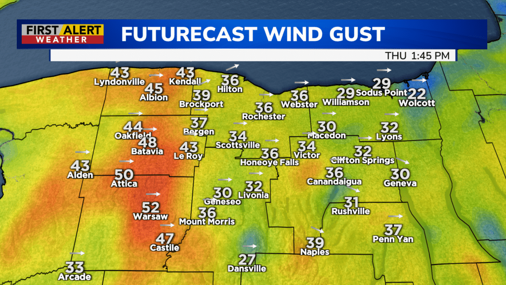
ROCHESTER, N.Y. – We had a little bit of everything with a warm front on Wednesday, including thunder, sleet, graupel, rain and a little wind. That warm front lifts north Wednesday night, with rain also lifting north, then gradually tapering. Temperatures will actually be rising through the 50s and into the lower 60s by Thursday morning. Thursday will be a much milder day, with highs pushing the upper 60s, along with a few occasional showers. Total rainfall between Wednesday and Thursday will amount to about a quarter to three quarters of an inch for most of the area, heaviest near Lake Ontario. It’ll also be a little windy at times on Thursday, with some gusts near 40 mph, especially west and south of Rochester.
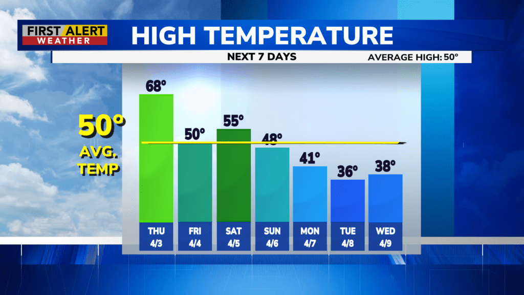
A weak cold front passing through late on Thursday will slowly drop our temperatures back to more seasonable levels, near 50 degrees on Friday. We’ll also get a break from the wet weather on Friday with a mix of clouds and sunshine.
The break is short-lived, with a return to rain on Saturday. There may be a period of a soaking rain as a warm front lifts through the region. A cold front will follow on Sunday, with another round of scattered showers, tending to taper later in the day. Then we’re in for a few chilly, and wintry days early next week, including highs in the 30s, a brisk wind and some snow showers.