First Alert Weather: Taste of summer warmth with a possible a late-day shower
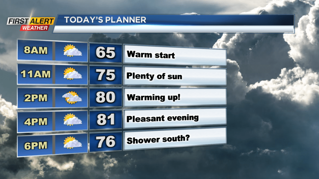
ROCHESTER, N.Y. — We’re waking up on Monday morning to a warm and dry start. Hazy sunshine is in store for us.
That haze is not due to wildfire smoke and no air quality affects are expected. Temperatures on Monday afternoon will also warm up nicely as we reach the 80 degree mark in the afternoon or the first time this season.
Monday will be a great day overall, however late in the evening and early Monday night, there is the chance for a shower or thunderstorm to pop up over the Finger Lakes. No heavy rain or severe weather is expected, but be mindful late Monday for areas south of Rochester, as there is a chance. Also on Monday, we will be tracking stickier conditions by the afternoon.
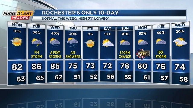
Nothing oppressive is expected, but dew points will climb into the low 60s which will be a bit noticeable. The humid weather will continue into Tuesday and Wednesday as well. Highs both of those day will reach the mid-80s and could feel closer to 90 at times.
With the extra moisture in the air, a few showers and storms will also pop up both of those days. An isolated shower or storm is expected on Tuesday with a greater chance for storms Wednesday as a cold front approaches.
We are going to keep our eyes on the chance of a strong storm or two on Wednesday. The humid weather will increase our thunderstorm energy locally and bring that chance for a stronger storm or two. As of now our threat remains low, but storms on Wednesday could have some strong gusty winds, small hail, and even locally heavy rain.