First Alert Weather: Tracking showers for Friday; potential for ice this weekend

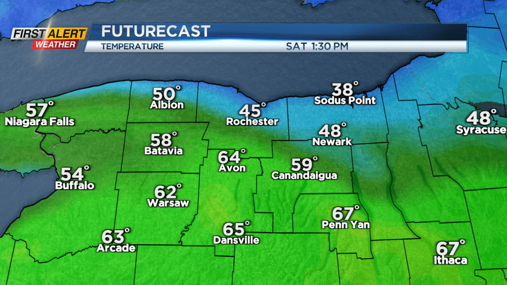
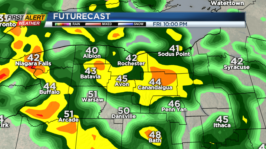
ROCHESTER, N.Y. – The sunshine and quiet weather we enjoyed on Thursday will eventually be replaced by some showers on Friday. We’ll start the day with some limited sunshine, but clouds will be winning out. Much of the day will be dry until a few scattered showers develop during the afternoon. A warm front will lift through Friday night, bringing a round of more widespread rain for a period. This is good news, as this means much of the area should be mild enough for just rain showers for much of Saturday. That being said, there will likely be a large temperature difference from the Lake Ontario shoreline, down to the NY/PA border, with 30s near the lake and 60s or even 70 well south.
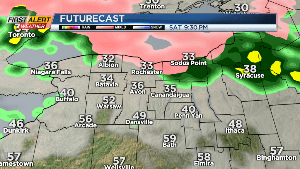
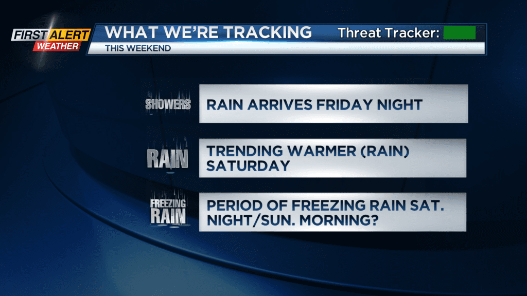
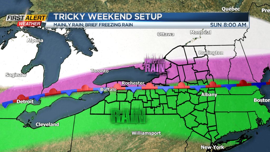
The boundary will sag southward a bit Saturday night into early Sunday morning. This is the time period when we could see some pockets of freezing rain developing, mainly north of Rochester and near the lakeshore. We may see some icing last into early Sunday morning, before the boundary lifts north again, pushing any ice back to the north, and being replaced again by just rain. At this point, we don’t expect any icing to be significant enough for any Alert Days, but the forecast will be monitored closely into the weekend.
Monday could see a push of milder air, with another batch of rain showers, followed by a cold front and falling temperatures late in the day. High pressure should build in quickly behind this for Tuesday, meaning dry weather and some sunshine for the Red Wings home opener, but it’ll be a chilly game, with temperatures likely in the 30s.