First Alert Weather: Tracking some weekend snow
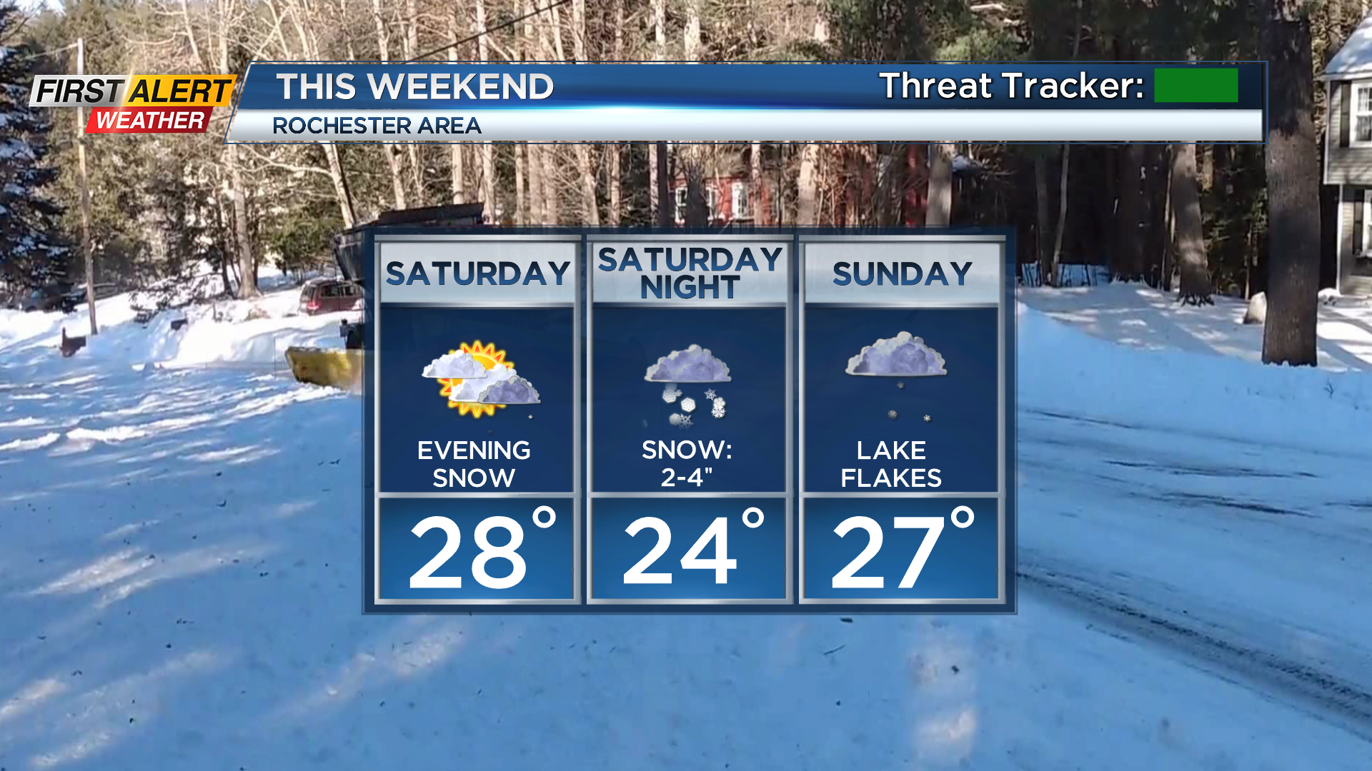
ROCHESTER, N.Y. – It’ll be a cold but quiet start to the weekend, with a partly cloudy sky Friday night leading to temperatures in the mid teens Saturday morning. The wind will also continue to ease through the overnight. Saturday starts off with at least some sun, but that will fade as clouds move in ahead of our next system. This is a storm that will bring an area-wide accumulating snow to the region, starting Saturday evening. The light snow will begin to accumulate after the sun sets, and we’ll see a few hours of a steady light to moderate snow toward midnight.
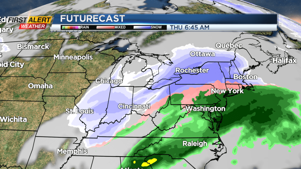
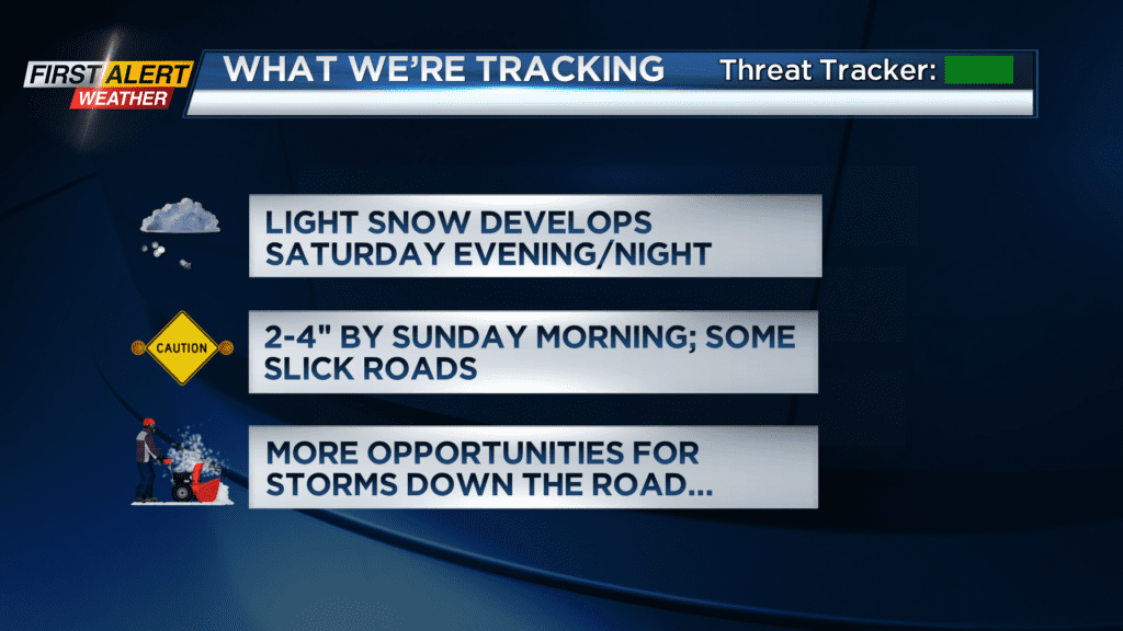
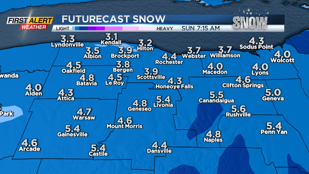
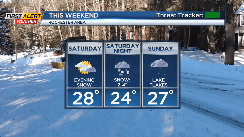
Steady snow tapers by Sunday morning to scattered snow showers and some off and on lake effect snow. In all, expect an inch or two Saturday evening, 1-3″ Saturday night, and another inch possible on Sunday. In total, most will see about a 2-5″ accumulation. Roads may be a little slick at times, but impacts should be fairly minor, as most of the snow will fall overnight when there is less road traffic.
Monday may see some lingering lake flurries early, followed by quiet weather and some clearing. The next storm system looks like it’ll pass by far enough to our south that there will be little to no impact locally on Tuesday and most of Wednesday. That being said, another storm will be on its heels, with the potential for another, possibly more substantial snowfall Wednesday night and into Thursday of next week. This is still about 5 days out, and the exact track of this next storm will be crucial as far as snow accumulations. The First Alert Weather Team will monitor both the weekend snowfall, and the storm next week for any changes. Watch News10NBC and download the First Alert Weather app for the latest updates.