First Alert Weather: Yellow Alert due to icy mix with more snow on the way
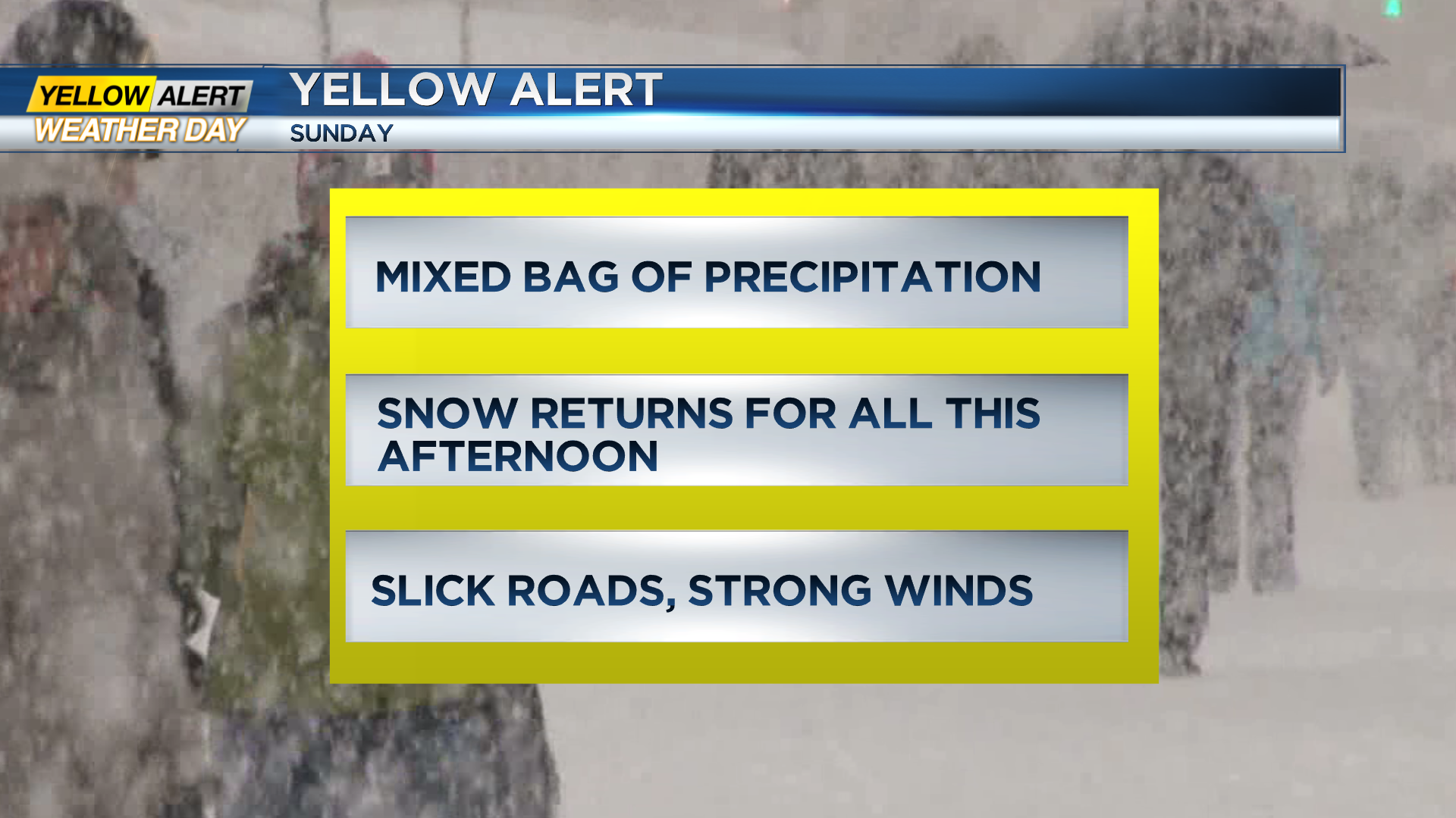
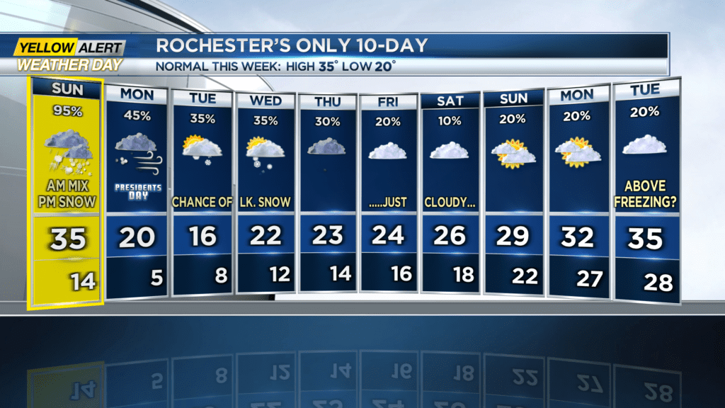
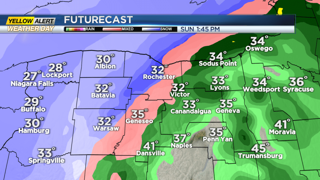
ROCHESTER, N.Y. We are under a Yellow Alert today as a storm system moves through our area bringing a mixed bag of hazardous weather. Many areas will see freezing rain, sleet, and regular rain that will eventually all change over to snow this afternoon. Snowfall amounts will vary widely depending on the exact location, but in general areas to the northwest including Orleans and Genesee County will see 3-5″, areas ranging from Livingston County northeast to Wayne County will see 1-3″, and parts of Ontario and Yates County will see less than an inch. Rain may wash away most of the snow, especially south towards the Finger Lakes. Chances for freezing rain have increased northward since the last forecast:
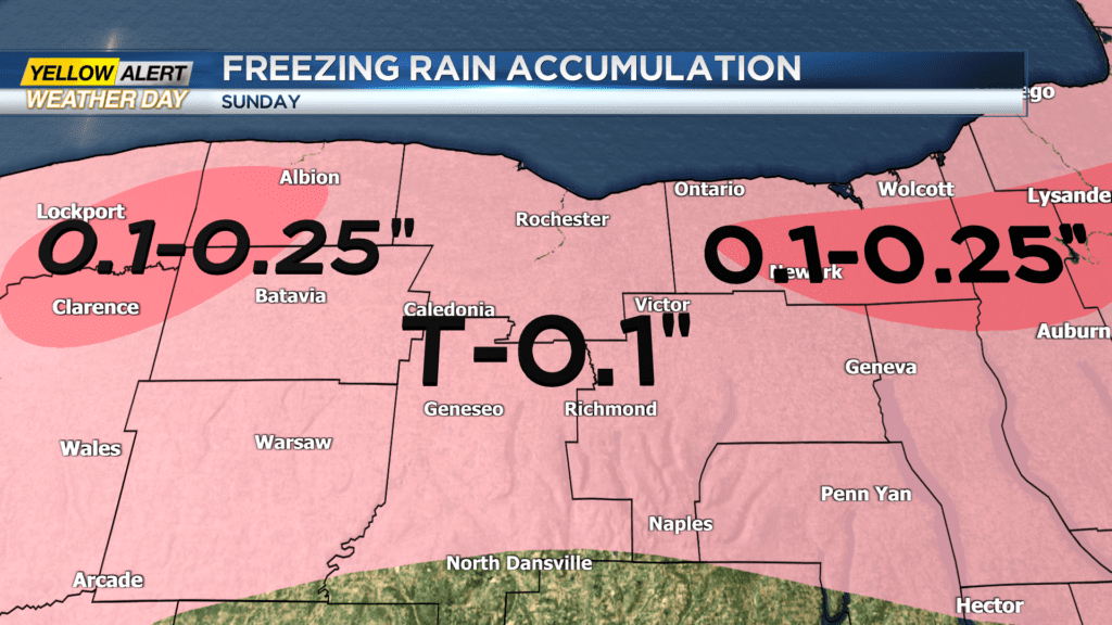
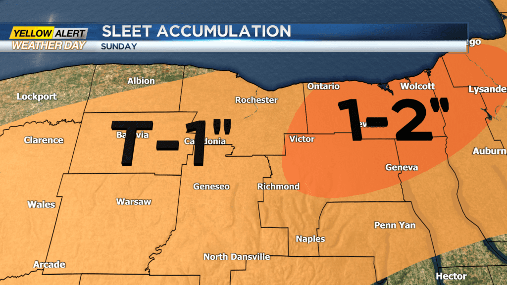
Sleet will be an issue as well, with trace amounts up to 2″ possible:
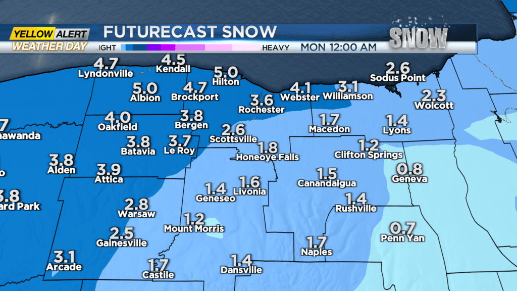
Over the course of the afternoon snow will take over from west to east:
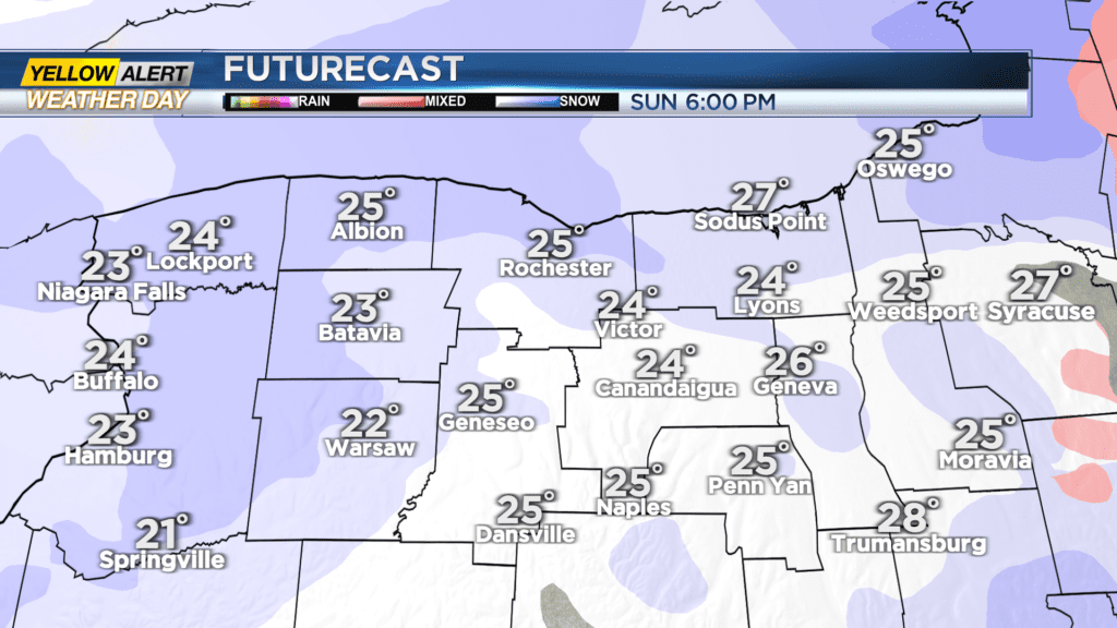
Then tonight winds pick up and we change over to lake effect snow following a strong cold front. Areas that see mostly rain will refreeze as temperatures plummet, and any slush or snow will freeze over… with the new lake effect snow falling on top. Needless to say, this is not a good day or night to travel.
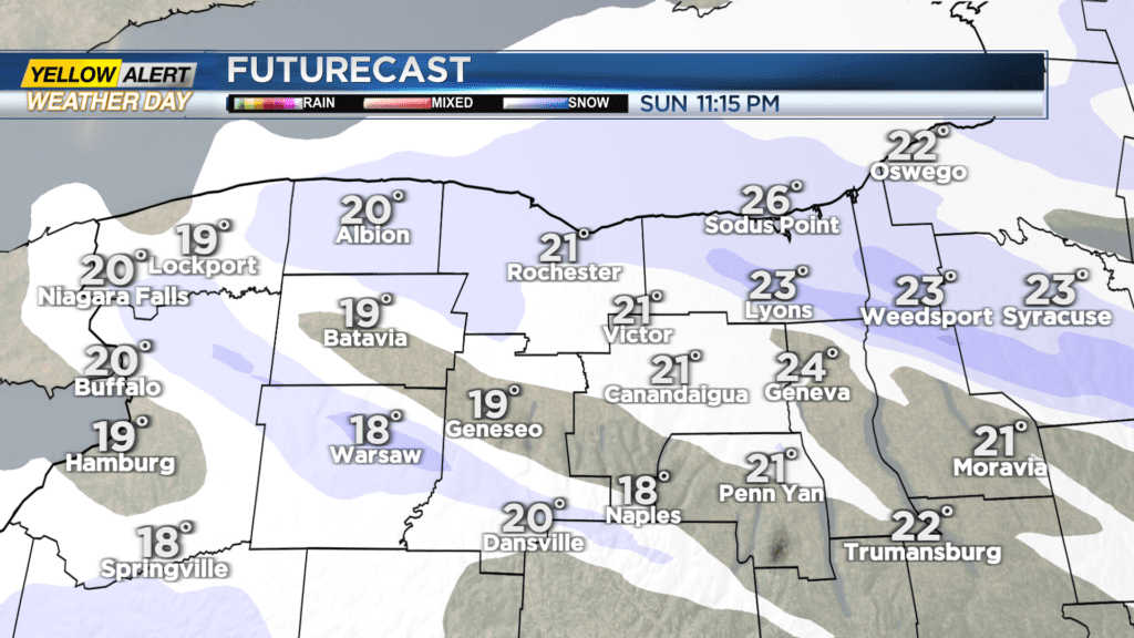
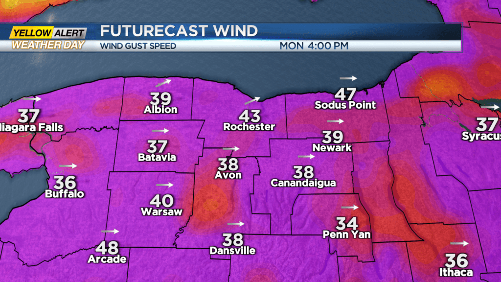
An additional 1-3″ of snow is possible Monday mainly along the lakeshore, and wind gusts could reach up to 40-50 MPH Monday afternoon.
All in all, there’s a little bit of everything going on today weather-wise. What you need to know is that in general, ice and rain will change to snow this afternoon, then temperatures plummet and winds pick up as lake effect snow begins. Travel will be difficult, and isolated power outages are possible… Better to stay inside, stay warm, and stay dry. But most importantly, stay safe. Stay tuned to News10 NBC as we continue to track the storm.