First Alert Weather: Yellow Alert is over but lake flakes and cold remain on Wednesday
ROCHESTER, N.Y. — After several days of bitterly cold temperatures, strong winds, and accumulating lake snow, our weather will be calming down a little for Wednesday.
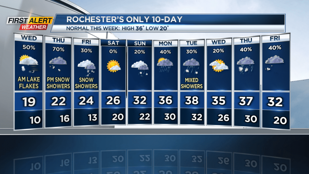
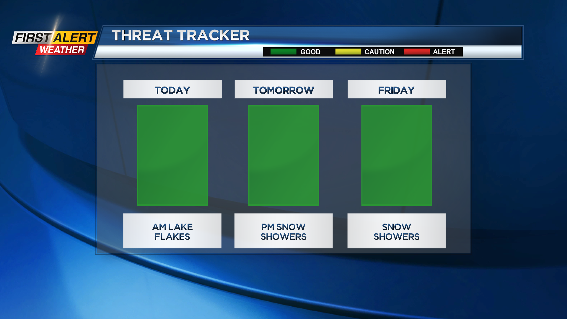
While we have ended the Yellow Alert, we aren’t flake-free. Lake effect snow has been mainly hugging the lakeshore and has caused some accumulation of light, puffy flakes. Most areas will only see a few more tenths of an inch of snow today, but some areas in Orleans County/western Monroe County could get another inch and a half.
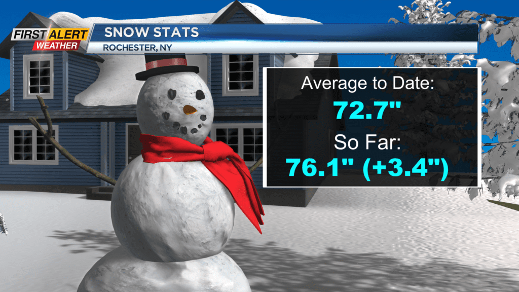
Speaking of snow, did you know that we’ve finally reached above average snowfall status for the season? I know, crazy right? Quite a turnaround from the last two years, and we’ve still got plenty of winter left.
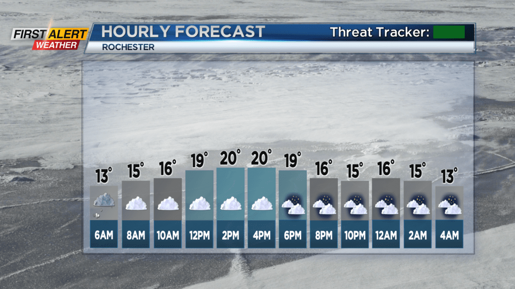
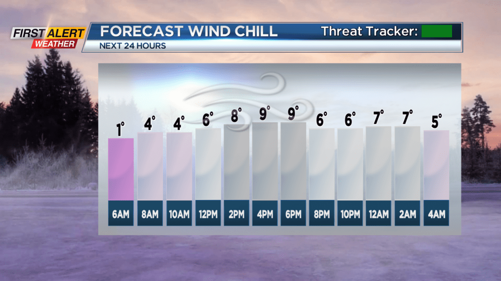
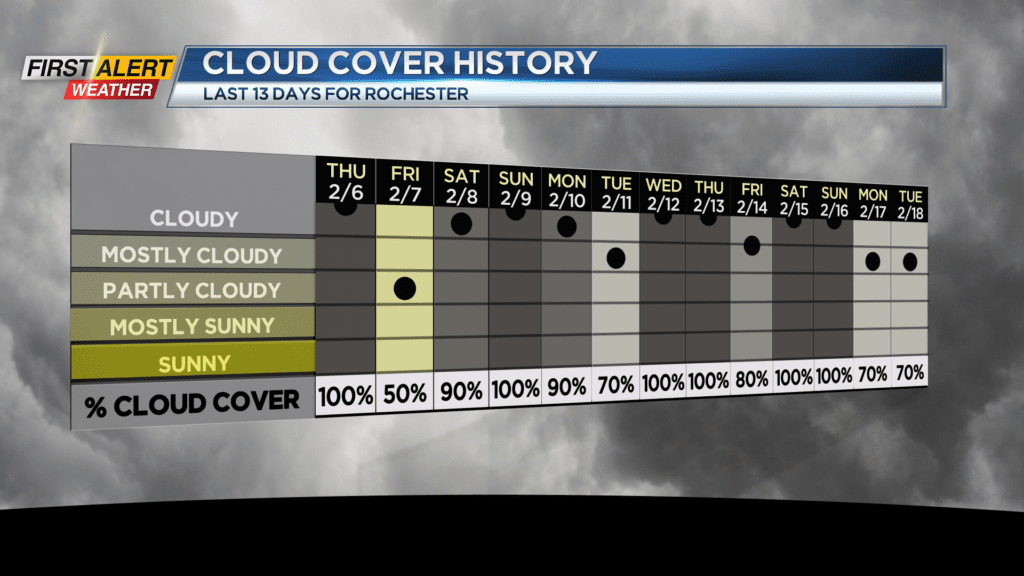
Temperatures will continue to be of a bone-chilling nature, with Wednesday’s high forecasted to reach 20 degrees with a wind chill of 9. Alongside the light snow showers, skies will be mostly cloudy… As they have been for quite a while now. The last time we had under 50% cloud cover over the course of a day was Dec. 14.
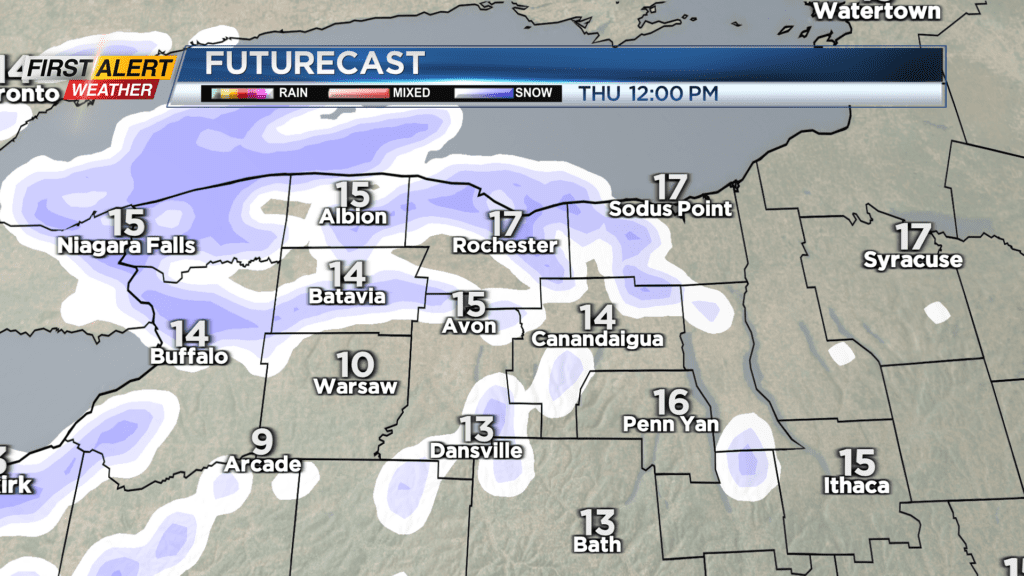
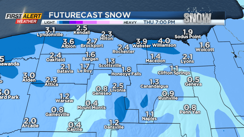
A little patch of moisture moving east from the Ohio River Valley combined with northerly wind tomorrow will result in some area-wide snow showers, with 1-3″ expected overall. Some minor impacts to travel are not out of the question for the evening commute, but for now we are still Green on the Threat Tracker.
Temperatures will see a steady rise over the next 7 days, but our weather pattern will continue to stay active with several chances for both large and small-scale precipitation events. Friday sees another chance of snow showers, before a mostly dry weekend highlighted by the return of some sunshine for Saturday.
Stay tuned to News10 NBC for all your First Alert Weather updates, and stay warm today!