First Alert Weather: Yellow Alert Sunday for strong to severe storms
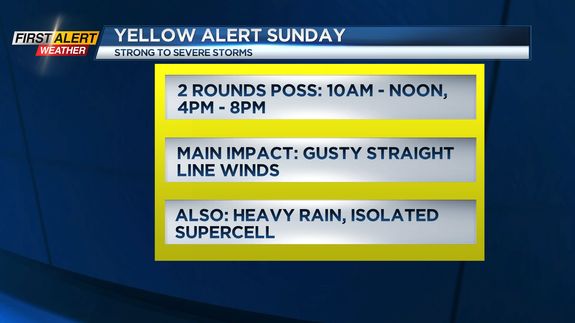
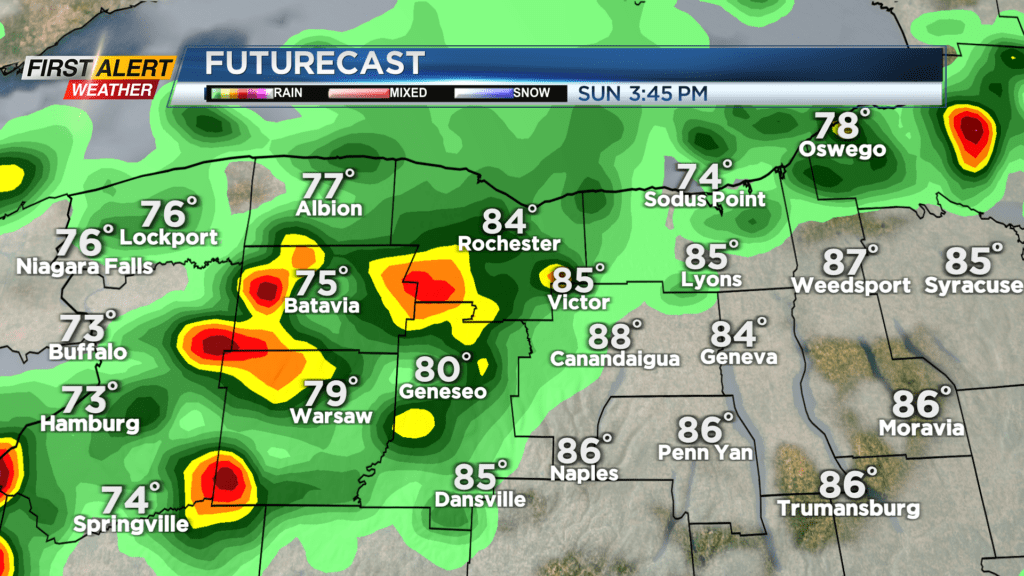
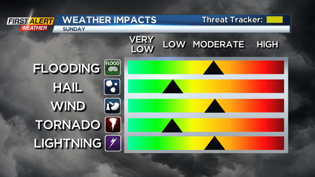
The First Alert Weather Team has highlighted Sunday with a Yellow Alert for the potential for some strong to possibly severe thunderstorms. If you have plans to be outside on Sunday, you need to pay extra attention to the forecast, and have a way to get weather alerts. A cold front approaching the area on Sunday will produce potentially two rounds of thunderstorms: one in the mid to late morning ahead of the front, and another in the mid to late afternoon as the front approaches. While storms aren’t a guarantee for everybody, any storm that does develop has the potential to produce damaging wind gusts, lightning and very heavy rain. Storms should move along fast enough to limit flood potential, but some standing water is possible on roads. The main damaging wind threat is straight line wind damage, but a few rotating supercells are possible. So, the tornado threat is low, but it isn’t zero.
Before the storms move in, we’ll see a few showers or thunderstorms through Saturday night, along with very warm and humid conditions once again. Certainly an air conditioning night, if you have it! Once the cold front moves through on Sunday, we’ll feel much more comfortable air with lower humidity blowing in on Monday. A few brief showers may linger into Monday, but the majority of the day should be dry, with highs in the 70s. We’ll briefly warm up once again on Tuesday with a good deal of sun, while a few showers may be possible late in the evening and especially on Wednesday, when another round of storms is likely.