First Alert Weather: Fall weather for western NY, Hurricane Milton strengthens again
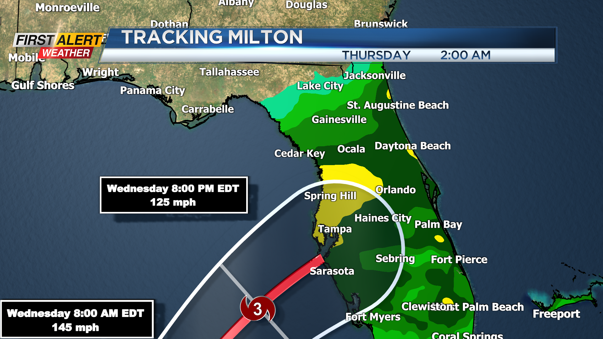
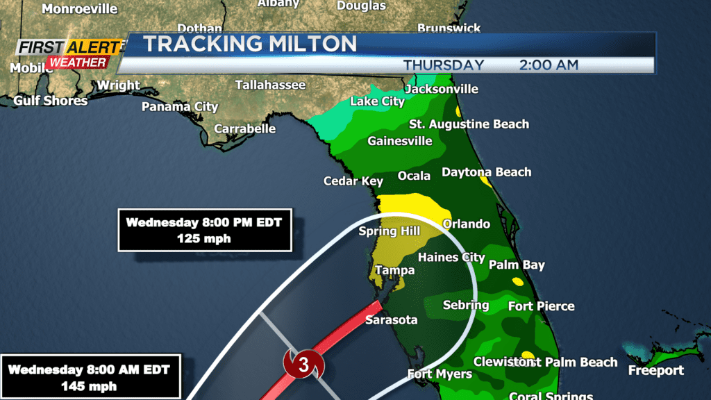
ROCHESTER, N.Y. — Starting off with Hurricane Milton, which is still an extremely dangerous hurricane in the Gulf of Mexico, continues to strengthen back into a high end category 4/category 5 storm. The latest forecast track keeps the main center line of the forecast in the Tampa/Sarasota/St. Pete Beach area.
This is still a worst case scenario for the Tampa area with storm surge pushing 10-15 feet, winds in excess of 100 mph as it makes landfall, plus fresh water flooding from rain and possible tornadoes. Milton will maintain hurricane strength as it quickly moves across the sunshine state, exiting back into the Atlantic ocean Thursday morning. Landfall is expected late Wednesday night/early Thursday morning.
Back here, our weather is much quieter, with classic fall conditions. In fact, we saw a few water spouts over Lake Ontario Tuesday morning, and we could see a few more on Wednesday. We’ll continue with our cooler pattern, giving us highs in the 50s and lows in the lower 40s on Wednesday.
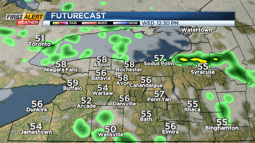
We’ll once again see sun giving way to periods of clouds and passing rain showers. Thursday may start off with a brief shower, but we should clear out nicely with more sun by the afternoon. That being said, Thursday will likely be our coolest day with highs only in the mid 50s. Friday should rebound back into the 60s with a good deal of sun.
The weekend will be mixed, with mostly dry weather at this point on Saturday (though we’re tracking a front), and a better chance for periods of rain and a noticeable breeze on Sunday.

