First Alert Weather: Lake snow winds down Wednesday night
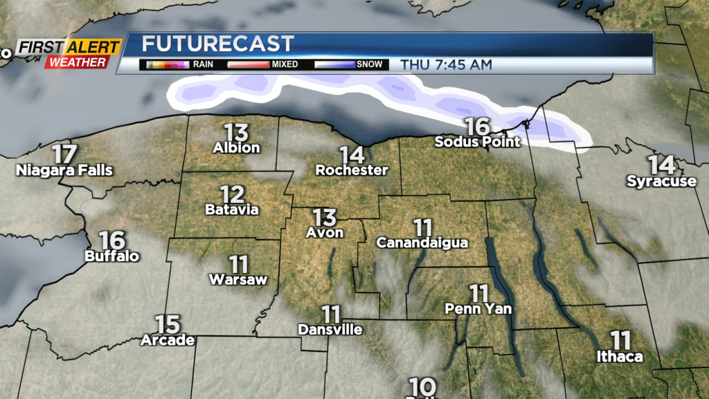
The steadiest lake effect snow winds down Wednesday night, and so does our Yellow Alert. We’ll see some minor lake effect snow continue, especially in northern Monroe and Wayne counties, with another inch or two of snow there. Elsewhere, expect little additional accumulation. Temperatures will drop into the teens and we’ll see a partially clearing sky.
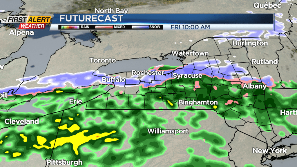
This will set us up for a chilly start to Thursday, but with calm weather, aside from some lake flakes in Wayne County. We’ll see intervals of clouds and sun on Thursday, then clouds thicken up again ahead of our next system. Warmer air will be drawn into western New York, with temperatures actually climbing through the 20s into the 30s by Friday morning. In fact, it’ll be mild enough on Friday for some rain showers to fall before transitioning back over to some wet snow late. We could see a few inches of slushy wet snow by Friday night.
The weekend starts off chilly with temperatures in the teens and low 20s on Saturday, but with some sun. Sunday will see increasing clouds and a few rain or wet snow showers later in the day. Our weather may turn more active next week, with a boundary overhead and a few waves of low pressure riding along that front, but details are fuzzy at this point. We’ll update the forecast as it becomes more clear.