First Alert Weather: Summertime weekend before storms this week

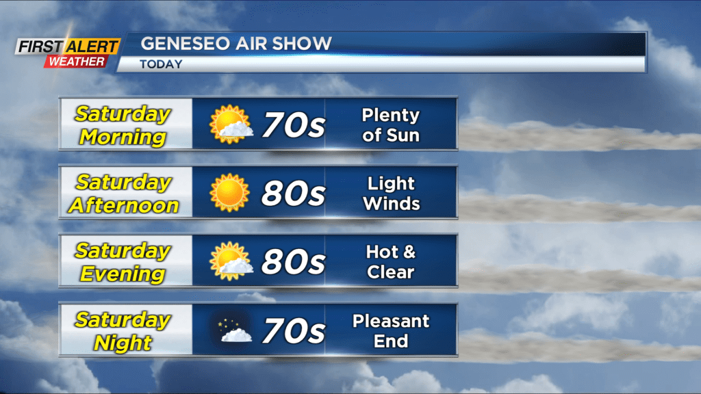
Waking up to a bit of a sticky and warm start this Saturday. Dew points will drop into the 50s Saturday afternoon, so after a sticky start we are a little more comfortable later on. Temperatures will still be on the warm side as they reach the mid 80s Saturday afternoon. The skies will remain clear for the majority of the day as plenty of sunshine remains in the forecast. We will stay dry on Saturday and for most of Sunday, but on Sunday there will be the chance for a late day storm.
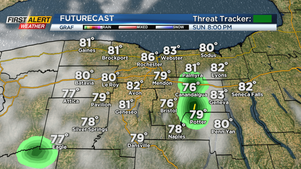
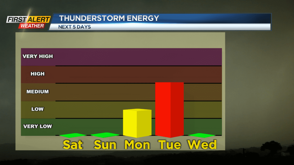
Sunday will feature another mostly sunny day before a few clouds begin to bubble Sunday evening. The morning and afternoon will be dry with highs near 90, but during the late evening and early overnight period there is the slight chance for a pop up shower or storm. Severe weather is not expected, and storm chances are limited. This is thanks to an approaching cold front that will eventually swing by on Monday. This front is rather weak, but a few thunderstorms are possible Monday afternoon. A gusty shower or storm looks possible, but it is not widespread and our severe weather chance are low.
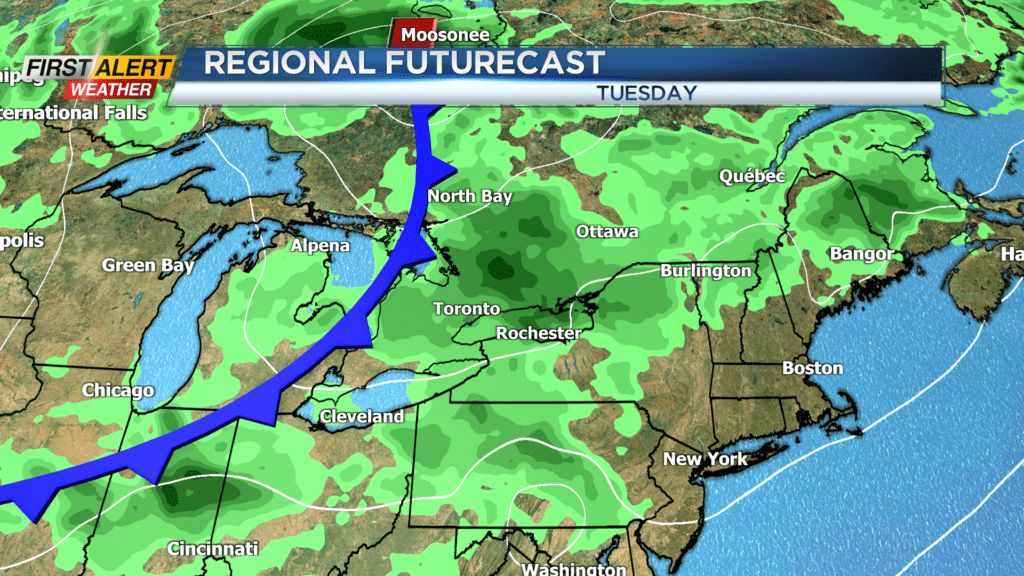
Tuesday will feature a stronger cold front with showers and storms as well. There is a little more thunderstorm energy available on Tuesday with a chance for gusty shower and storms too. Our severe threat on Tuesday is a little higher, but the timing of the cold front will be key. If the front passes by too early or too late, then it won’t have time to interact with the thunderstorm energy. If it swings by in the afternoon on Tuesday, there will be a greater chance for severe weather. Unlike this past Wednesday, there will not be as much spin in the atmosphere so a tornado threat is virtually non-existent.