Yellow Alert Weather: Tracking high winds in the Rochester area on Monday
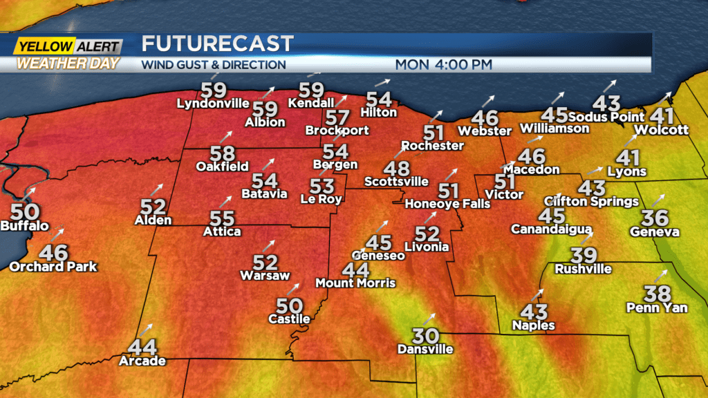
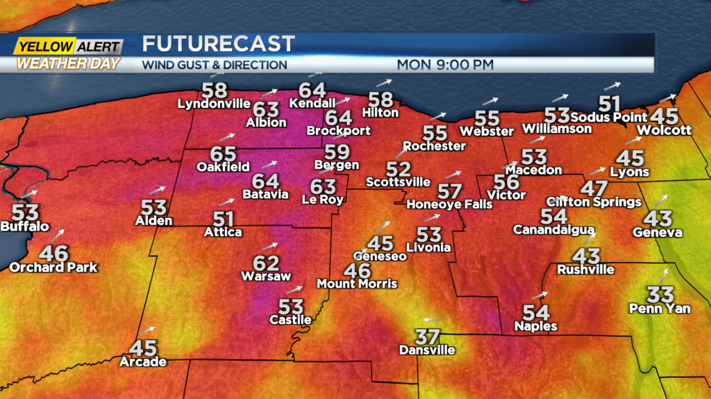
ROCHESTER, N.Y. — In the old days we used to say, “hold onto your hat”. We are talking about the potential for strong winds on Monday and how these wind speeds will be even higher near the Great Lakes. The closer you live to Lake Ontario or Lake Erie, the better chance that you will experience winds of 60 miles per hour or higher.
The question is how much wind does it take to move an object? Obviously, it depends on the size of the object, but a speed of 30 miles per hour can push a trash bin down the roadway. If we get winds of 70 miles per hour the average size person can actually get pushed along pretty easily. And if you get a wind gust of 90 to 95 miles per hour a small car could be buffeted. We warn about the hazards of driving a high-profile vehicle such as tractor-trailer truck or towing a camper.
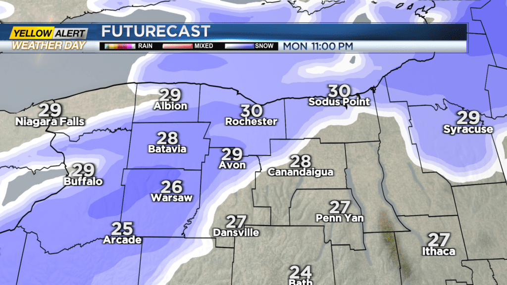
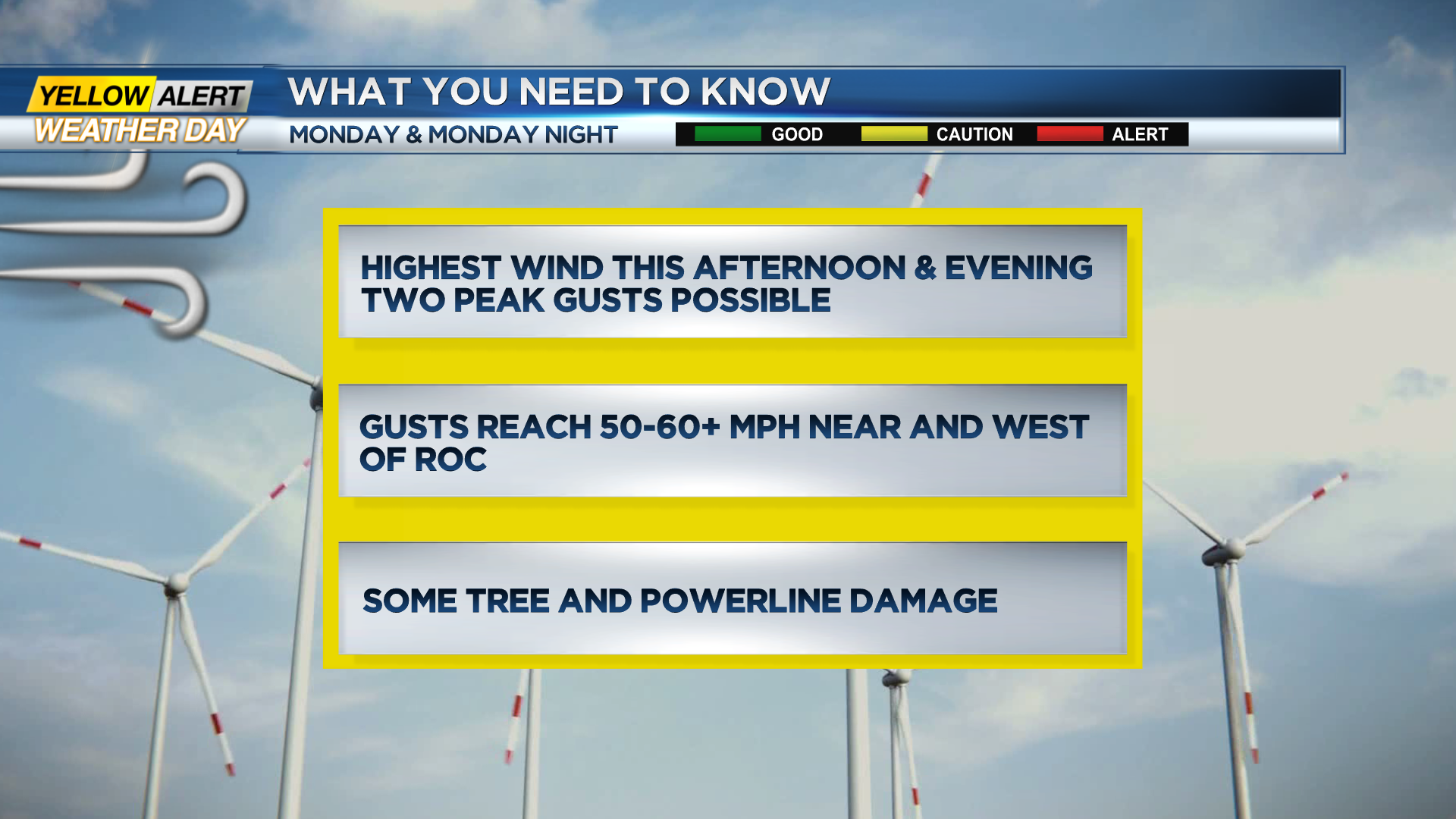
This time around our biggest potential hazard is a power outage. However, we are fortunate that after the cold wave this month, Western New York is on solid frozen ground. This ensures that tree roots are locked in the ground. However, falling tree branches are still a big concern and we feel there is a moderate risk of power outage through Monday evening. The News 10NBC First Alert meteorologists expect winds near 50+ miles per hour with gusts near 60+ miles per hour west of Rochester.
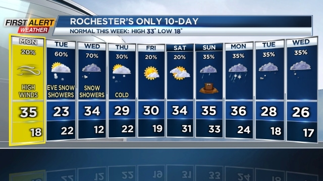
From a meteorological perspective, this storm is very interesting. It is a very deep low-pressure system that is located 600 miles to the north of Rochester, near James Bay, Canada. A good distance away from the Flower City, but still having a huge impact. This storm then begins to move away later tonight which will lessen strongest gusts. Then, by mid-week, we move onto the next storm which is a fast-moving “clipper” system. This will have an impact during Tuesday and Wednesday with snow and yes, a lot of wind.